The Tibetan northwest
The high staircase: a gorge two kilometres deep, pilgrim villages under the unclimbed ice wall of Kawagebo, and China's most accessible 5,000-metre summit. 3,000 metres and up.
 Start your enquiry
Destinations / Yunnan
Glaciers and rice terraces, a gorge deeper than the Grand Canyon, tea mountains and elephant forest — all in one province the size of California. This plate holds every Yunnan journey, guide and field note we run.
Explore the guide ↓Southwest China · Yunnan Province
Yunnan is a staircase that never stops. In one province you can walk a glacier under the 6,740-metre ice wall of Kawagebo, cross a gorge the Jinsha river cut two kilometres into the earth, cycle around a highland lake at 2,000 metres, pick tea where the tea-horse caravans began, and finish in a tropical valley where elephants hold the right of way. Few regions on earth pack this much vertical — and the human variety that grew along with it — into a single journey.
Three facts shape every Yunnan plan. First, elevation: the northwest sits above 3,000 metres and Shangri-La sleeps at 3,300, while the southern lowlands are tropical — routes are built low-to-high or split into separate journeys. Second, season: the province is a year-round destination, but each window owns different places — the terraces' flooded mirrors run November to April, the northwest is cleanest from late spring to autumn, canola sets Luoping alight in February and March. Third, roads: the mountains that make Yunnan beautiful also make travel days long, so our itineraries string their highlights along one line and accept the drive.
Start with a region below, or go straight to the journeys. Every page on this plate links back here, and everything links onward to the hub pages — trekking, mountaineering, cycling, wildlife and food — where the same journeys live alongside the rest of the collection.
Yunnan divides naturally into four — pick the one that matches your season, or read all four and let them argue.
The high staircase: a gorge two kilometres deep, pilgrim villages under the unclimbed ice wall of Kawagebo, and China's most accessible 5,000-metre summit. 3,000 metres and up.
The relaxed heart: a lake ringed by cycling roads, the Bai heartland, the wild Nu river valley at the Burmese border, and a volcano country that soaks in hot springs.
The tropical rim: the tea mountains where the caravans began, Dai temple towns on the Lancang (Mekong), and the elephant forests of the south.
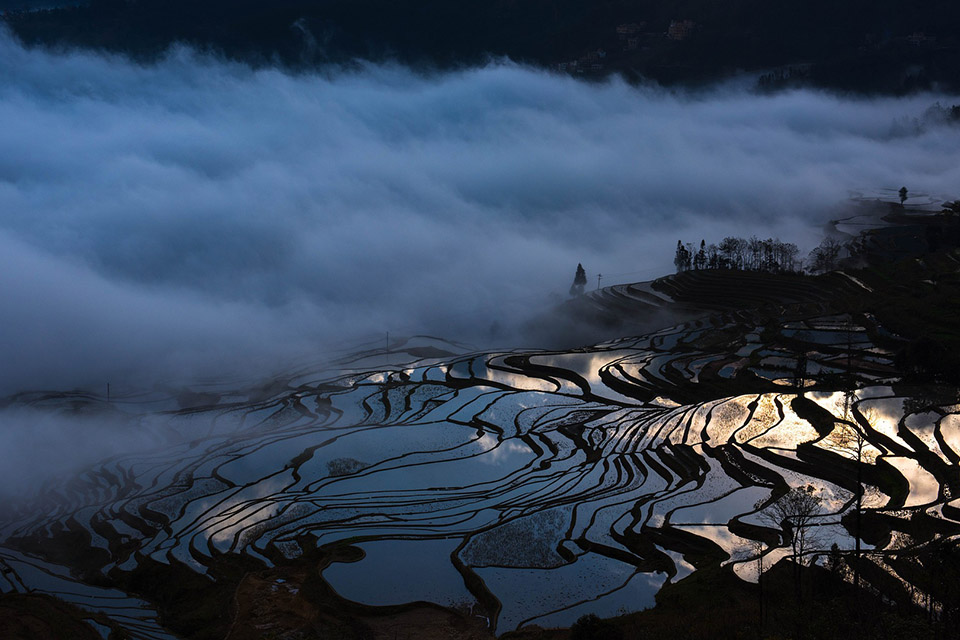
The sculpted earth: Hani rice terraces that mirror the sky all winter, canola seas each February, and the red land that made a hundred photographs.
A destination guide for each anchor of the plate, plus a practical guide for every planning question — seasons, transport, food, altitude and the rest.
Green Lake mornings, the flower market and the museum — the spring city worth a day of its own.
Bai courtyards, the Cangshan cloud trails and the Erhai ring road — the province at its most relaxed.
The canals of Dayan, the villages of Baisha and Shuhe, and the massif above them.
Songzanlin monastery, Dukezong and Napa Hai at 3,300 metres — with the acclimatisation built in.
The Feilai dawns, the Yubeng village and the glacier tongue under Kawagebo.
Liuku to Bingzhongluo: villages, cable crossings and the great First Bend.
Sixty-eight cones, the boiling springs of Rehai and the library village of Heshun.
The Hani terraces and their water season — three dawns, properly placed.
Jinghong on the Mekong, the Dai temple towns and the elephant forests.
Four regional calendars, month by month — and the honest monsoon truth.
Crossing-the-bridge noodles, mushroom season and the Dai grill — province by province.
The four-vertical-kilometre staircase, acclimatisation rules and the kit lists.
Every private Yunnan itinerary we currently run, across five hub collections. Each opens with a full day-by-day, an honest difficulty note and a price guide.
The high-country line done properly: Shangri-La's monastery, the gorge road west, and two nights at the foot of the Meili range with dawn on Kawagebo.
The village with no road in — walk the kora paths under the ice wall to the holy waterfall and the glacier lake.
The famous two-day crossing on the path above the Jinsha river — Tea Horse Guesthouse, the Twenty-Four Bends, and the gorge floor at the end.
The friendly giant next to the Jade Dragon: a two-day climb with a summit win over the gorge country at 5,396 m.
Lakeside cycling the way it should be — west-shore villages, the Erhai ring road, and Dali's old town evenings.
Down the last wild river: Liuku to Bingzhongluo along the Nu, lantern-strung cable villages, the First Bend and the mist of the Fogli village paths.
From the ancient tea trees of the Pu'er mountains to the Dai heartland on the Lancang — tea pressing, temple towns and the elephant country of Wild Elephant Valley.
The southeast's two great light shows worked at dawn pace: the flooded Yuanyang mirrors and the Luoping canola sea, with the stone villages between.
Volcano country and the birds' mountain: hot-spring valleys at the foot of young volcanoes, Heshun's stone lanes, and the Gaoligong forest walks.
The painter's palette at working pace — the red fields, the fallen gully of Luoxia and the thousand-year trees, from a mountain lodge that watches the dawn.
Into the fir forests of Baima Snow Mountain to meet the Yunnan snub-nosed monkey — the "snub-nosed children of the snow".
Yunnan runs year-round — but each window owns different places. Most travellers should pick one and build around it.
The southeast's best months: the Yuanyang terraces flood into mirrors, the sky doubles itself, and spring festival light fills the villages. February adds the Luoping canola and the Dai new-year build-up; the northwest stays cold and clear.
The northwest's quiet best: rhododendrons on the Cangshan, young barley around Shangri-La, warm days on the Erhai. Rain builds late in the window — routes carry flex days.
The whole province fires at once: harvest gold in the terraces before the flood, clear skies over the Meili range, mushrooms finishing in the markets and the red land freshly ploughed. The single best window for a first Yunnan journey.
July–August is the green season: warm, wet and dramatic. High treks run with rain plans, leech socks and flexible schedules — we say so plainly rather than pretending otherwise.
Stories from our teams across the province — the texture behind the routes.
What the unclimbed massif does to the light, and to the people who stand under it.
Dawn in the pilgrim village under Kawagebo, where the morning arrives on horseback.
The Hani water system that has kept the terraces flooding for thirteen centuries — and the families who still walk the channels.
The Friday market that kept a tea-horse town alive after the caravans stopped.
Mules, tea bricks and credit ledgers — the logistics that carried Pu'er over four thousand metres.
A few weeks each summer when Yunnan stops talking about anything else.
Kawagebo, 6,740 metres: the climbing history that ended in a ban, and what the mountain means to the pilgrims who circle it.
How the wild elephants of Xishuangbanna shape every journey that enters their valley.
The Yunnan facts that change each year — snow seasons, terrace water, festival dates — tracked on their own pages.
Meili snow outlook, the terrace water window, festival dates and flight news — one page, checked against official sources.
Tell us your season, your legs and your altitude comfort. We build Yunnan journeys along one line — high country or terraces or tea mountains — with the current access and weather picture checked before anything is promised.
Start my journey brief ↗