The Altai north
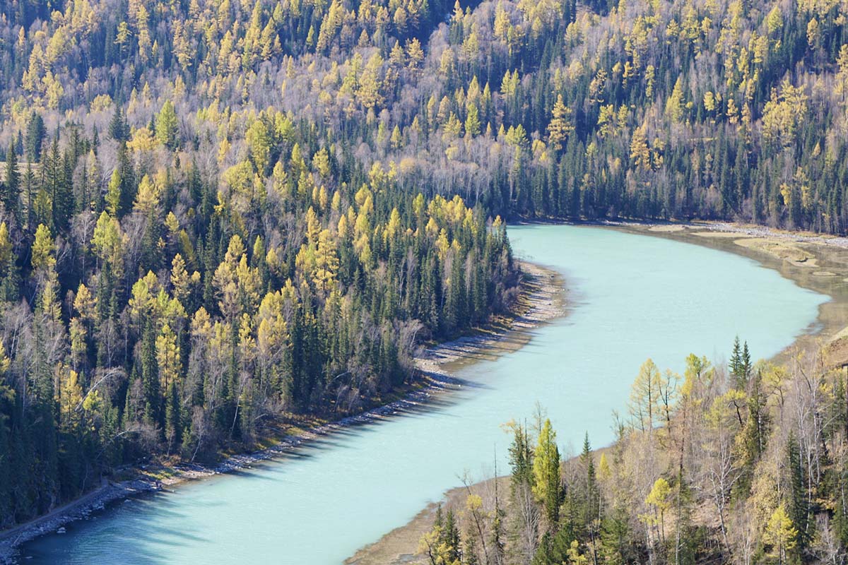
Siberian larch, turquoise rivers and wooden villages — China's autumn capital, and its deepest winter powder. June meadows, late-September gold, November to April snow.
 Start your enquiry
Destinations / Xinjiang
A third of China, and almost none of the crowds. Deserts, glaciers, grasslands and the last great road journeys on the map — this plate holds every Xinjiang journey, guide and field note we run.
Explore the guide ↓The far west · Xinjiang Uyghur Autonomous Region
Xinjiang is the size of a continent and behaves like several. In a single fortnight you can ski powder in the Altai, cross the Tianshan on a two-thousand-year-old horse road, walk the lowest oasis city on earth, and stand under the 7,546-metre ice dome of Muztagh Ata above the Karakoram highway. This plate gathers everything we run in the region: the journeys themselves, a guide for each of its four grand regions, field notes from our teams, and the seasonal news that matters — when the Duku highway opens, when the snow falls, when the poplars turn.
Three facts shape every Xinjiang plan. First, distance: the places that look adjacent on a map are a day's drive apart, so every itinerary we build strings its highlights along one line instead of zig-zagging. Second, season: the regions open in different windows — the Ili grasslands want June, the Altai wants late September or deep winter, the south wants spring and autumn — and the best Xinjiang journeys are built around two of those windows, not all of them. Third, access: some valleys and borders open and close with the seasons and the years; we track the current situation for every route we sell and say so plainly on each page.
Start with a region below, or go straight to the journeys. Every page on this plate links back here, and everything links onwards to the hub pages for trekking, mountaineering, skiing and the desert where the same trips live alongside the rest of the collection.
Xinjiang divides naturally into four — pick the one that matches your season, or read all four and let them argue.
Siberian larch, turquoise rivers and wooden villages — China's autumn capital, and its deepest winter powder. June meadows, late-September gold, November to April snow.
The green heart: grasslands folded like corduroy, glaciers at the head of green valleys, and the old horse roads — Wusun, Xiata — crossing the wall of the Tianshan.
The dry heart: a depression 154 metres below the sea, ruined cities, underground rivers and the sweetest grapes in Asia. Walkable, winter-friendly, and the easiest first step.
The high heart: the caravan capital of Kashgar, the Karakoram highway to 7,546-metre Muztagh Ata, and the poplars of the Tarim rim in their brief gold.
Every private Xinjiang itinerary we currently run, across four hub collections. Each opens with a full day-by-day, an honest difficulty note and a price guide.
A full expedition on the father of ice mountains: three high camps on the west ridge, two rotations, and a midnight push to a summit with the whole Pamir on the horizon.
The 120-kilometre crossing of the Tianshan from the Ili grasslands to the desert rim — two passes near 3,900 m, glacial river crossings, and Paradise Lake at the end of the world.
Xuanzang's mountain of ice, without the full crossing: four walking days up a forested valley to the snout of the Muzart glacier and a camp under the icefall.
The two golden weeks worked properly: dawn on the river bends, evenings in the wooden villages, and the Wuerhe ghost city on the road home.
Three resorts — a 5S mountain inside Altay city, China's biggest verticals at Koktokay and Jikikpulin — and two nights in snowbound Hemu village.
The depression at walking pace: karez channels, dawn in the Jiaohe ruins, the Tuyoq valley village and the Kumtag dunes — below sea level, and kind all winter.
Turpan, Kuqa and Kashgar along the Taklamakan's northern rim — the classic southern line, with the Kizil caves and two unhurried days in the old city.
The classic overland approach to Xinjiang from Xi'an and Lanzhou — often the first half of a longer silk road arc.
Four windows, four different Xinjiangs. Most travellers should pick two and plan around them.
The Ili's month: Sayram lake at full blue, the Kalajun in wildflower, the high passes just cleared of snow. The Wusun and Xiata treks start their windows here. The east is already heating up.
The Altai's two weeks of larch colour — the most photographed landscape in China and still worth the crowds, worked around them. The south cools to its walking best; the Tarim poplars turn at the same time.
The Altai holds China's longest, driest ski season — late October to early April. Meanwhile Turpan becomes winter-walkable, and the south stays crisp and clear.
May and August are the honest in-between months: August is hot everywhere but the high valleys, and the rivers on the treks run highest. We say so on every itinerary rather than pretending otherwise.
Everything our team has written from Xinjiang and the silk road, gathered here — the stories behind the routes.
What the colour window actually looks like on the ground, and how to work the valley around the crowds.
The 4,000-year-old poplar forests of the Tarim rim, and the week each autumn when they burn.
What the four-thousand-year-old burials in the regional museum do to every assumption you brought.
How thirty-kilometre tunnels of gravity and clay keep the greenest oasis in China alive below sea level.
Laghman, polo, naan and the fruit season — a working map of the region's food geography.
Water, beds, camels and credit — the logistics that made the oases rich long before the tourists.
The Xinjiang facts that change every year — road openings, snow seasons, colour forecasts — tracked on their own page.
Duku highway opening dates, the Altai snow report, poplar forecasts and access changes — one page, checked against official sources.
Tell us your season, your legs and your appetite for distance. We build Xinjiang journeys along one line, at one season's pace, with the current access situation checked before anything is promised.
Start my journey brief ↗