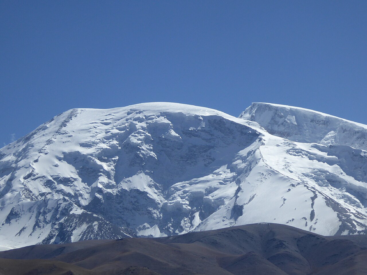
Muztagh Ata 7,546 m
The father of ice mountains: three high camps on the west ridge, two rotations, and a midnight push — the standard first 7,000er, run with licensed guides and a filed permit.
 Start your enquiry
Destinations / Xinjiang / The Pamir & the south
The high heart: the caravan capital at the end of the silk road, a highway climbing into the Pamir past a 7,546-metre ice dome, and the Tarim's poplar forests burning gold for two weeks each autumn.
Explore the guide ↓Southern Xinjiang · Kashgar & the Tarim rim
Everything in the south converges on Kashgar — the oasis at the western end of China where the silk road's northern and southern rims met, the caravans re-grouped, and two square kilometres of rammed-earth lanes grew into the finest surviving silk road town on earth. The old city is the region's anchor: coppersmiths, naan ovens set into the walls, the Id Kah mosque at the centre of the shell.
West of the city the Karakoram highway climbs toward the Khunjerab pass, and the geography turns vertical. Karakul lake at 3,600 m sits directly under Muztagh Ata — the 7,546-metre ice dome Kirghiz herders call the father of ice mountains, and the most accessible 7,000er in China. Beyond it, Tashkurgan's stone fortress and the stone-paved grasslands under the Pamir's wall. This is our mountaineering country: the Muztagh Ata expedition runs here every approved season.
East of Kashgar the land falls to the Tarim basin and the Taklamakan's western horn — the desert rim where the world's great poplar forests line the dying rivers, gold for about two weeks each late October. The south rewards two trips in one: a high trip to the Pamir, and a desert trip along the rim, and both begin in the same caravan city.
The mountain, the lake, the city and the desert rim.
The father of ice mountains: three high camps on the west ridge, two rotations, and a midnight push — the standard first 7,000er, run with licensed guides and a filed permit.
Turpan, Kuqa's Kizil caves, and two unhurried days in Kashgar's old city — the southern rim worked as one line, ending where the routes met.
A cold turquoise sheet under Muztagh Ata with Kirghiz yurt camps on the shore — acclimatisation ground for the expedition, and a destination in its own right.
One of the great drives on earth — up the gorges, past the lake, to Tashkurgan's stone city and the Khunjerab pass at 4,693 m when the border season allows.
The desert rim's ancient poplar forests in their two gold weeks — a field note on where and when the colour burns.
Spring and autumn own the south.
The Pamir opens, Karakul thaws, the expedition's early rotations begin. Kashgar is warm, the rim is kind, and the light is long.
The south cools to its walking best; the poplars burn for two weeks at the end of October; the expedition's main summit window closes mid-August and the desert rim takes over.
The Karakoram highway stays open most winters and the south is crisp, empty and cold — the old city is atmospheric, the lake is ice. A specialist's season; ask.
Border-zone rules around Tashkurgan and permit seasons on the peak change year to year. Every southern journey carries the current situation at enquiry — said plainly, checked each time.
Long legs, big rewards.
Kashgar has daily flights from Urumqi — the standard gateway. Overland arrivals come up the Hexi corridor or across from Ili through Kuqa; the oases journey strings the whole rim.
Kashgar to Karakul is 200 kilometres of climbing road; the rim towns are hundreds of kilometres apart. Southern itineraries are built as lines with flight shortcuts — never as loops that fight the map.
Kashgar has the region's characterful best; Karakul is yurt camps; the rim towns are simple and friendly. The expedition's base camps are full-service.
The caravan city's inheritance.
Two square kilometres of lanes and courtyards — walk them with a local guide who belongs to the neighbourhoods, early and late, and let the city be a city.
The rawap and the muqam tradition, the livestock market's handshake economy on Sundays, the bazaar's corridors of silk, knives and dried fruit — the south's culture is its commerce, honestly conducted.
Kashgar's kitchen is the silk road on a plate: polo, laghman, baked buns, yogurt with honey, and naan the size of a wheel.
Altitude, documents, patience.
Karakul at 3,600 m and the pass at 4,693 m are real altitudes — one night acclimatising, easy first days, and the guide's call on any high-side walking.
Border-zone travel toward Tashkurgan requires permits arranged in advance; the Muztagh Ata expedition carries its own climb approval. We handle the paperwork; bring your passport everywhere.
The south pairs with Ili over the range — the full Tianshan arc — or follows the east on the oases line. Either way, it is the finale the silk road deserves.
The mountain or the rim — or the caravan city on its own. Tell us your window and we will build the south around the season's honest limits.
Start my journey brief ↗