Ili & the Kalajun grasslands
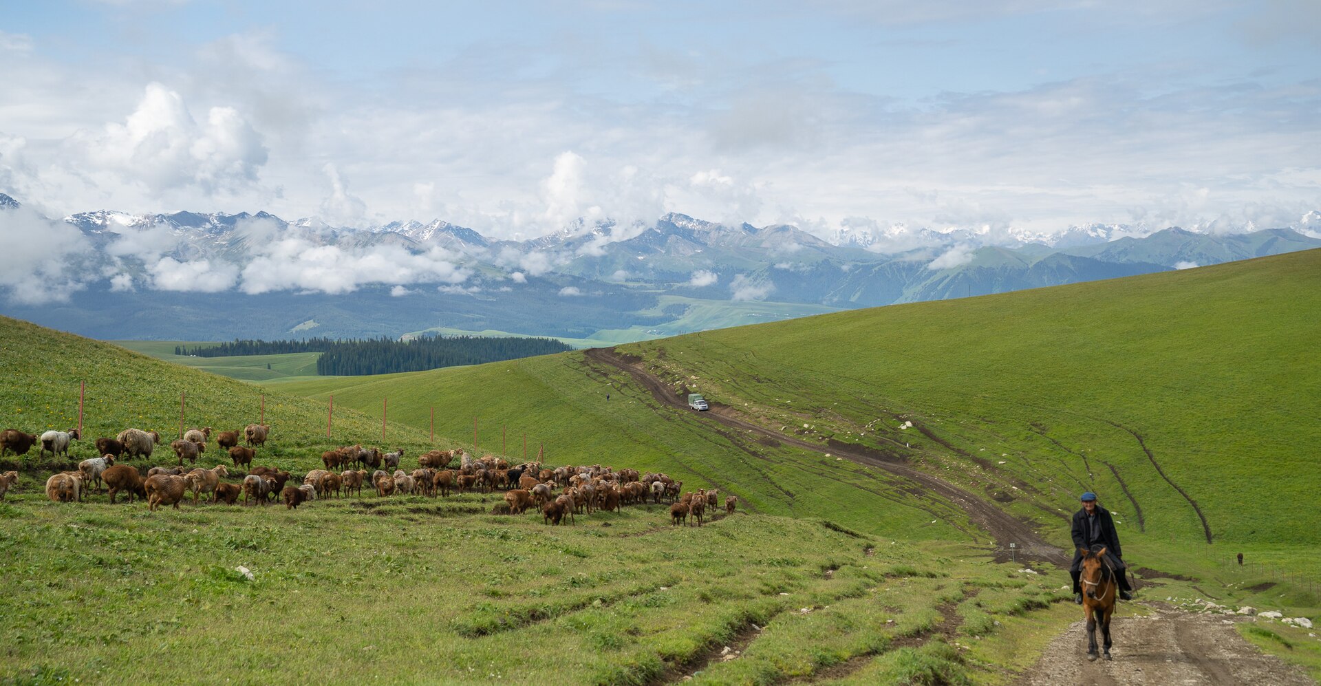
Rolling alpine pasture at 2,000–2,500 m, Kazakh herding camps and the June–July flower season. This is the best walking country in the region and the core of our Tianshan journeys.
 Start your enquiry
Destinations / Xinjiang
Grasslands under snow peaks, lavender valleys in the Ili basin, desert lakes and the Silk Road cities at the edge of the map. Xinjiang rewards travellers who give it room.
Explore the guide ↓Northwest China
Xinjiang is the size of a subcontinent. A journey here is built around two or three bases — the Ili valley and the Tianshan, the Altai north around Kanas, or the Kashgar south — rather than a loop that ticks off every name on the map.
The Tianshan range runs like a spine through the region, inscribed by UNESCO in 2013 for its four component landscapes, including the Tomur massif at 7,443 m. North of the range lie the Kazakh grasslands of Kalajun and Nalati; south lies the Tarim Basin and the Taklamakan.
Distances are the planning fact that matters most. Urumqi to Kashgar is roughly 1,400 km by air, and the scenic drives that link trailheads take full days. We shape routes so the driving earns its scenery.
Regions and experiences to shape a Xinjiang journey around.
Rolling alpine pasture at 2,000–2,500 m, Kazakh herding camps and the June–July flower season. This is the best walking country in the region and the core of our Tianshan journeys.
A glacial lake in Siberian-style forest near the borders of Kazakhstan, Mongolia and Russia. Village bases at Hemu and Baihaba, autumn colour in late September.
The old town, the livestock market and the Karakoram Highway toward Tashkurgan. Some border areas require additional permits arranged in advance.
China’s lowest and hottest basin, at 154 m below sea level, with ancient karez irrigation channels and Uyghur grape trellis villages.
A cold blue alpine lake at 2,070 m on the northern slopes of the Tianshan, passed on the drive between the Ili valley and Urumqi.
Xinjiang is a May–October region; each month moves the scenery.
The Ili valley is green, flowers are out and herding families are in the high pasture. This is the window for our Kalajun and Ili walking routes.
Kanas and Hemu turn gold. Days are short and nights are near freezing, but this is the most photographed fortnight of the northern year.
May and October bring thinner crowds and unreliable passes. Winter travel is possible city-to-city but closes the mountain country.
Connections, bases and the practical details that hold a good route together.
Urumqi is the hub; Kashgar, Yining and Altay are practical secondary gateways. Build the itinerary around where you actually land.
Two to five hours between highlights is normal in the Ili valley. We plan stops, meals and walks so the vehicle days still feel like travel.
City hotels are straightforward; grassland stays range from herder yurts to comfortable guesthouses. We set expectations honestly before you commit.
Make room for local life, food and cultural encounters.
Uyghur, Kazakh, Han, Kyrgyz and Mongol communities share the region. Food alone — laghman, samsa, roast lamb, naan from a tandoor — is worth the journey.
Evening muqam performances in Kashgar, livestock markets in the west, bazaars everywhere. Ask us what is running on your dates.
August and September bring melons, grapes and stone fruit to the southern oases. A slow food day in Turpan is a genuinely good travel day.
Useful details to discuss when shaping your trip.
Carry your passport for intercity checks, which are routine. Some western border areas need extra permits; we arrange these before departure.
The region runs on Beijing time, so summer evenings stay light until very late. Plan walking days around the long dusk rather than the clock.
Tell us how long you have and which landscape pulled you here. We will build a route with realistic distances, good walking and stays worth the drive.
Start my journey brief ↗