
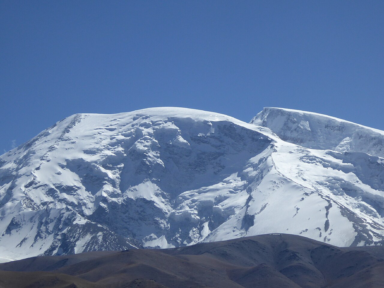
Mountaineering / Muztagh Ata 7,546 m
Private high-altitude expedition
Muztagh Ata: the 7,546-Metre Expedition
Muztagh Ata is the mountain that teaches you what altitude actually costs. Its snow dome is almost perfectly non-technical — no ice walls, no knife-edge ridges — but it stands 7,546 metres above the Pamir plateau, and the air up there holds a third of the oxygen you were born with. This is a full expedition, not a trek: base camp, three high camps, rotations, a weather window, and a summit day that starts at midnight.
Ask about this itineraryMuztagh Ata, 7,546 m — the father of ice mountains, rising directly above the Karakoram highway
second-highest of the Kunlun–Pamir knot, and the most accessible 7,000er in China: the Karakoram highway passes its base, and base camp sits an hour's walk from the road
base camp on the moraine, then three camps on the west ridge — camp 1 at 5,560 m, camp 2 at 6,100 m, camp 3 at 6,800 m — each a long snow-plod higher
approach and acclimatisation from Kashgar, two full rotations to load the high camps, then a summit window — the mountain is climbed on its schedule, not yours
Muztagh Ata is Uyghur-Kirghiz for father of ice mountains; ski-mountaineers prize its gentle, consistent slopes for the descent
Why this mountain
A 7,000er you can actually plan for.
Most 7,000-metre peaks live behind weeks of walking orTechnical climbing. Muztagh Ata's genius is its approachability: you drive from Kashgar along the Karakoram highway, sleep the first nights beside the turquoise mirror of Karakul lake at 3,600 m, and walk into base camp across easy moraine. What remains hard is exactly what should be — the altitude. The route is a sustained snow slope; the enemy is the height, the cold and the weather, not the terrain.
This is a fully supported private expedition with licensed high-altitude guides, rope-fixed camps, oxygen for emergencies, and a kitchen that follows you up the mountain. It suits climbers with solid 5,000-m and ideally 6,000-m experience — our Siguniang and Yuzhu programs are the natural rungs below it. Climbs run inside the official summer window, typically mid-June to mid-August.
Route Briefing
In via Kashgar and Karakul lake, onto the west ridge through three camps, summit from camp 3 in a pre-dawn push, then straight down the line of ascent. Two full rotations before the summit window — no short-cuts on a mountain this size.
- undefinedundefinedundefined
- undefinedundefinedundefined
- undefinedundefinedundefined
- undefinedundefinedundefined
- undefinedundefinedundefined
- undefinedundefinedundefined
The Expedition
Eighteen days on the father of ice.
The plan below is the standard shape of a Muztagh Ata climb. Exact camp days move with the weather and the team's acclimatisation profile — the itinerary has room to breathe because the mountain always takes some.
-
Day 01
The caravan city
Arrive Kashgar
Arrive in Kashgar, the great oasis town at the western end of China's silk road. The team briefs in the evening: equipment check, the season's permit situation, and an honest conversation about how everyone is travelling. Kashgar sits at 1,290 m — low enough to sleep well, which matters from here on.
-
Day 02
Old city, and a last real bed
Kashgar
A gentle day in the old city — the lanes, the coppersmiths, the naan ovens set into the walls — while the expedition food and ropes are sorted. Any missing personal gear can be bought or hired in town. Evening to rest; the altitude starts tomorrow.
-
Day 03
Up the Karakoram highway
Kashgar → Karakul lake
The drive climbs the Karakoram highway past the geoglyphs of the Ogiz valley to Karakul lake, 3,600 m, with Muztagh Ata's white dome filling the southern sky. Sleep beside the lake in a Kirghiz yurt camp — first real acclimatisation night, and the mountain's presence made physical.
-
Day 04
Acclimatisation above the lake
Karakul lake
A walking day around the lakeshore and up a side valley to roughly 4,000 m — legs moving, lungs learning. Your guides check pulse oximetry and appetite, the two most honest indicators of how the acclimatisation is going. Back to the yurts for a second night at 3,600 m.
-
Day 05
Onto the moraine, 4,300 m
Karakul → base camp
A short drive then a half-day walk puts the team on the lateral moraine below the west ridge — base camp at 4,300 m, tents up, kitchen running, the route's lower slopes in view. From here everything you eat was carried in by camel, and every step serves one purpose: get well and strong at this height before asking for more.
-
Day 06
Rest, and training on the moraine
Base camp
A full rest day: rope and crampon refresher on a nearby slope, fixed-line practice, and the first weather forecasts for the ridge. Meals are engineered for altitude — heavy on fluids and carbohydrate. Sleep is the day's real work.
-
Day 07
First rotation: to 5,560 m
Base camp → camp 1
Rope up and climb the ridge's opening snow slopes to camp 1 at 5,560 m — six hours of steady plod with the whole Pamir unfolding behind you. Carry a load, pitch tents, melt snow, sleep high for the first time.
-
Day 08
Load camp 2 at 6,100 m, down to base
Camp 1 → camp 2 → base
The rotation's work day: carry to camp 2 at 6,100 m, leave tents and supplies, then descend all the way to base camp. Sleep-low-climb-high is the whole craft of this mountain — every rotation buys the summit day a little more margin.
-
Day 09
Rest and eat
Base camp
Base-camp day: hot showers from the meltwater tent, fresh food, laundry, and a long look at the forecasts. If the team is moving well this day may compress; if the weather is turning, it may grow.
-
Day 10
Second rotation begins
Base camp → camp 1
Back up the ridge to camp 1. The slope you struggled up four days ago should now feel like a staircase — that is the acclimatisation announcing itself. Early dinner, early sleep.
-
Day 11
Sleep at 6,100 m
Camp 1 → camp 2
Move up to camp 2 with the loads already in place, and spend your first full night above 6,000 m. Most teams feel the height here for an afternoon — headaches, broken sleep — before the body adjusts. The guides watch closely.
-
Day 12
Load camp 3, the last carry
Camp 2 → camp 3 → base
The long carry to camp 3 at 6,800 m — tents, fuel, food for the summit bid — then all the way down to base camp for a night of thick air before the window. This is the expedition's hardest working day, and the one that makes the summit possible.
-
Day 13
Climb to the window
Base camp → camp 1
The summit rotation starts as the forecast window opens. Climb to camp 1, rest in the evening, and watch the guides' final call on timing. From here the plan is simple: move up, sleep, and go for it.
-
Day 14
To the high camp at 6,800 m
Camp 1 → camp 3
A steady two-stage day via camp 2 to camp 3, arriving mid-afternoon. Sleep is brief and shallow at this height — that is normal — and the stove runs all evening melting water for the summit push. In bed by seven, awake by eleven.
-
Day 15
Summit day: the midnight push
Camp 3 → summit → camp 3
Leave at midnight into the cold. Six hours of headtorched snow slope brings first light somewhere below 7,200 m, and the summit — a broad snow crest with the whole Pamir and the Karakoram's giants on the horizon — arrives late morning. Photos, no long sit-downs, and down to camp 3 by afternoon. 7,546 m.
-
Day 16
Everything down, all at once
Camp 3 → base camp
Strip the high camps and descend the ridge in one long day to base camp. The air feels drinkable. Celebration dinner, and the team's first real sleep in two weeks.
-
Day 17
Out by the lake
Base camp → Karakul → Kashgar
Walk out past Karakul lake — now looking impossibly low — and drive to Kashgar by evening. Certificates, photographs, and a late dinner in the old city.
-
Day 18
Fly on
Depart Kashgar
Transfer for onward flights. If the climbing habit has taken hold, talk to us about the natural next steps in the progression — the mountains above 7,500 m are few, and planning for them starts years out.
What's included
What is included, and what is not.
High-altitude climbing is logistics-heavy: the price is dominated by licensed guides, permits, camp infrastructure and the support team that keeps you fed above 6,000 metres.
Included
Arranged and paid in your price.
-
L
i
-
C
l
-
F
u
-
A
l
-
G
r
-
A
c
-
A
l
Not included
Either yours to arrange, or a question we will gladly answer.
-
F
l
-
P
e
-
P
e
-
P
e
-
V
i
-
S
u
Important, said plainly: peak permits above 7,000 m in China are approved by the national mountaineering authorities on a per-expedition basis, with applications lodged about three months ahead. Openings, quotas and the approval of specific nationalities change year to year — we confirm the current policy for your team at enquiry, before any deposit.
Enquiry
Ask about the expedition.
Tell us your climbing résumé — peaks climbed, highest altitude, recent seasons — and your target year. We will come back with the season's permit status, a training plan outline and a full cost breakdown.
- Difficulty
- Non-technical, extreme altitude
- Prerequisites
- 5,000 m experience essential; 6,000 m strongly advised
- Group size
- 4 – 8 climbers, private teams
- Cost guide
- From ¥49,800 per person, twin share
Enquiry sent
Thank you — your enquiry is with us.
We reply within one business day. A copy of what you sent has gone to your inbox.
Need to add something? Write to inquiry@chinadventure.com.
Back to the itineraryRead next