Guilin & the Li River
The city inside the towers, the 83-kilometre river, Xingping’s bend on the twenty-yuan note and a Ming princes’ palace at the foot of Duxiu Peak.
 Start your enquiry
Destinations / Guangxi
A province built of vertical rock and moving water. Karst towers along a hundred and sixty kilometres of river, rice terraces stacked six hundred metres up a ridge, and a volcanic island in the south.
Explore the guide ↓South China · the Guangxi basin
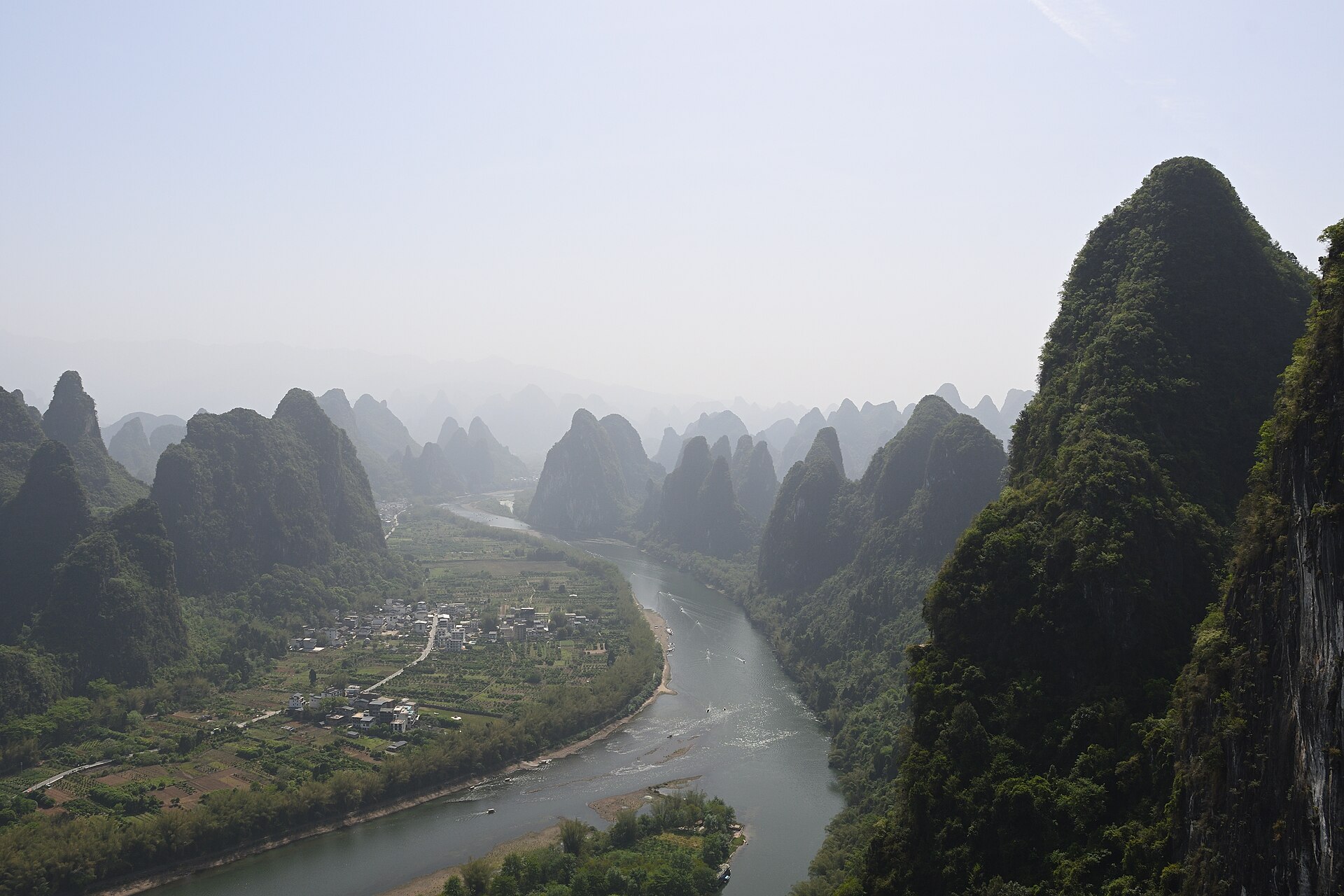
Guangxi is a limestone plateau that has been rained on for three hundred million years. The rock is Devonian marine limestone, laid down in shallow seas and then lifted, jointed and dissolved by a monsoon that drops well over a metre of rain a year. What is left is the most complete karst landscape in the world: tower karst in the river valleys, peak clusters on the plateau, caves and collapse shafts underneath both.
The consequence for a traveller is that Guangxi is not a province of big mountains. Its highest point, Mao’er Shan in the Yuecheng range, is 2,142 metres — lower than the road pass outside Chengdu. Almost everything worth doing here happens below 1,200 metres, which is why this is the one province on the site where altitude is not a planning problem at all.
Instead the province organises itself around water. The Li River runs 164 kilometres from the Yuecheng mountains to the Gui River, and the 83 kilometres between Guilin and Yangshuo are the most photographed river scenery in China. The Yulong, its longest tributary in Yangshuo county, runs 43.5 kilometres through the same towers and is the quieter of the two. South-west, the Guichun forms the Vietnamese border at Detian. And in the far south, the coast is volcanic rather than karst: Weizhou island is the youngest and largest volcanic island in China.
River karst, terraced ridges, collapse country, a border waterfall and a volcanic island.
The city inside the towers, the 83-kilometre river, Xingping’s bend on the twenty-yuan note and a Ming princes’ palace at the foot of Duxiu Peak.
China’s climbing capital: a thousand bolted lines on Devonian limestone, a river you float down, and 10 kilometres of paddy between the towers.
Sixty-six square kilometres of paddies stacked between 300 and 1,100 metres, farmed by Zhuang and Yao villages since the Yuan dynasty.
The world’s densest cluster of collapse dolines, a 613-metre shaft with forest at the bottom, and a cave system that swallows rivers.
A three-tier fall on the Guichun river, half in Vietnam, below a valley of karst paddies at Mingshi.
A young volcanic island 21 nautical miles offshore, with a crater bay, coral-stone church and the warmest water in the province.
Four published journeys, and a province that mostly rewards improvisation.
The four published journeys with days and prices, plus the three route shapes we build privately.
Yangshuo is the one place in China where a beginner and a 5.13 climber can share a crag and a car.
The Longji village trails and the Yangshuo countryside walks, both filed under hiking and culture.
What we have written about the province.
The karst, Todd Skinner’s 1992 route on Moon Hill, and how a rice town became the centre of Chinese climbing.
Which crag suits which grade, what a day costs, and why access at Moon Hill has been inconsistent.
The three terrace areas, the village-to-village paths, and how to choose a base.
The shorter, older guide to the city and the river.
A subtropical province with two dry windows and a long wet summer.
The best six weeks of the year: dry, 20–28 °C, clear light on the karst, and the rice turning gold at Longji before the harvest.
The second window. Warm, green, and prone to the low cloud that makes the towers look like a brush painting. Rock can stay damp after rain.
The wet season: 30–36 °C, high humidity, afternoon storms, and typhoons on the coast from July. The rivers run high and brown, and some rafting stops.
Cool and grey, 8–15 °C, with occasional cold snaps that reach the coast. Quiet, cheap, and the terraces are bare flooded mirrors.
The Guangxi facts that move: river height, terrace colour, typhoons.
River levels, terrace stages, the climbing season and the coastal typhoon window, on one board.
Why the Li is green in October and brown in June, and what high water does to the rafting.
Flooded mirrors in May, green in July, gold in September — and why the harvest moves up the mountain.
Tell us whether you want rock, water, terraces or the underground — and how much heat you can take. Those two answers set the month, and the month sets the province.
Start my journey brief ↗