
South China
Destinations / South China
Guangxi.
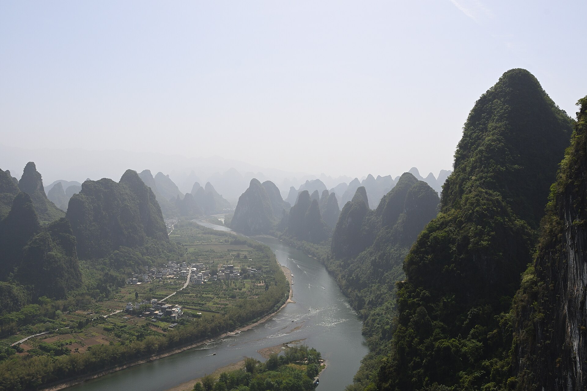
Three hundred million years of rain on limestone, and the most complete karst landscape on earth: towers along a river, paddies stacked a kilometre up a ridge, shafts six hundred metres deep, and a volcanic island off the coast.
1,000+ bolted climbing routes around Yangshuo — on the same limestone that collapses into 613-metre shafts at Leye
01 / Read the province
A province of standing rock.
Guangxi is a limestone plateau that has been dissolving for three hundred million years. The towers, the terraces, the caves and the collapse shafts are all the same rock, seen at different stages of the same process.
- 01
Guilin
The river · UNESCO 2014
- 02
Yangshuo
Climbing · 1,000 routes
- 03
Longji
Terraces · 650 years
- 04
Leye
Tiankeng · 613 m deep
- 05
Detian
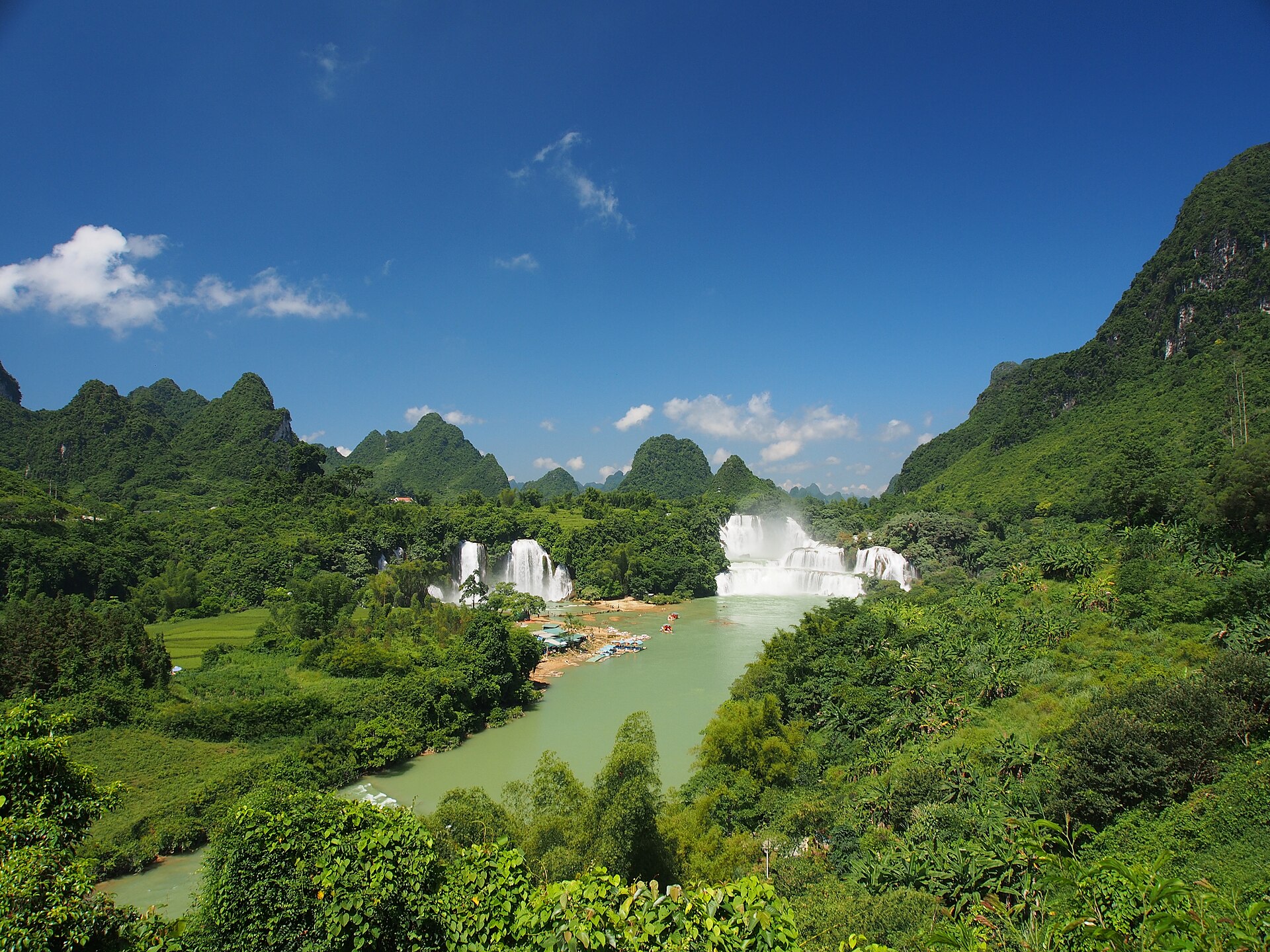
The border falls
- 06
Beihai
The volcanic island
Guilin, Yangshuo and Longji form a triangle of about two hours a side and belong in one week. Detian and Leye are four-hour drives from that triangle, and Weizhou needs a ferry and a weather window. Pick one of the two far wings, not both.
What to see where ↓02 / Choose a landscape
Three Guangxi, not one.
The river valley with its towers, the terraced ridge above it, and the collapse country in the far west. Each is a different journey, and only the first two combine easily.
The river and the rock
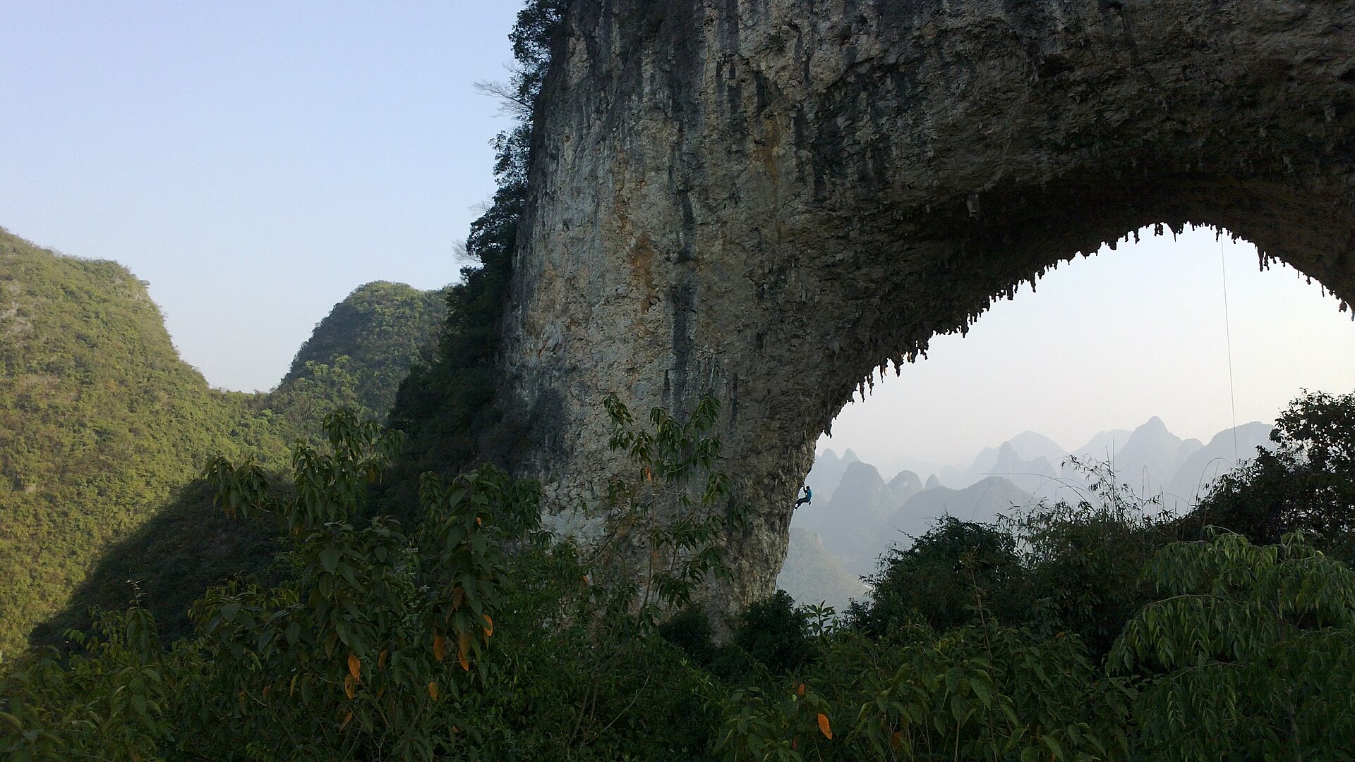
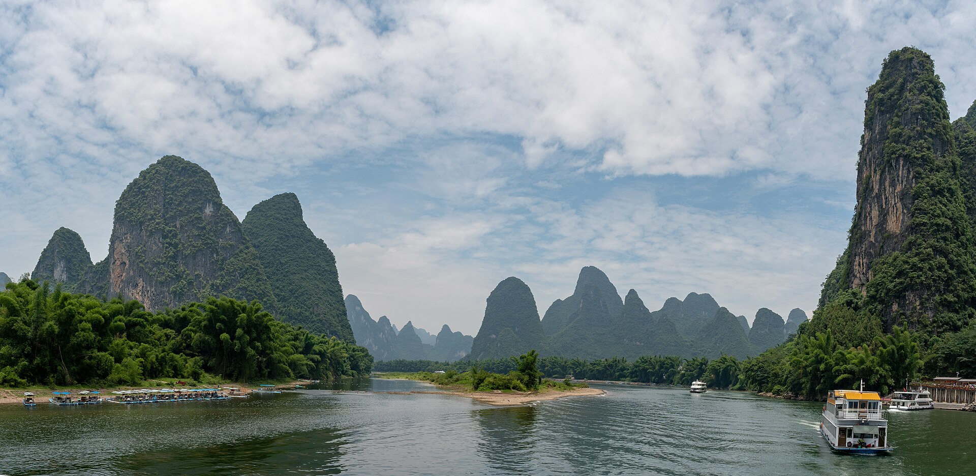
Eighty-three kilometres of the Li between Guilin and Yangshuo, and more than a thousand bolted routes on the towers beside it. The one part of China where a first outdoor day and a 5.13 project share a crag.
Down the Li River ↗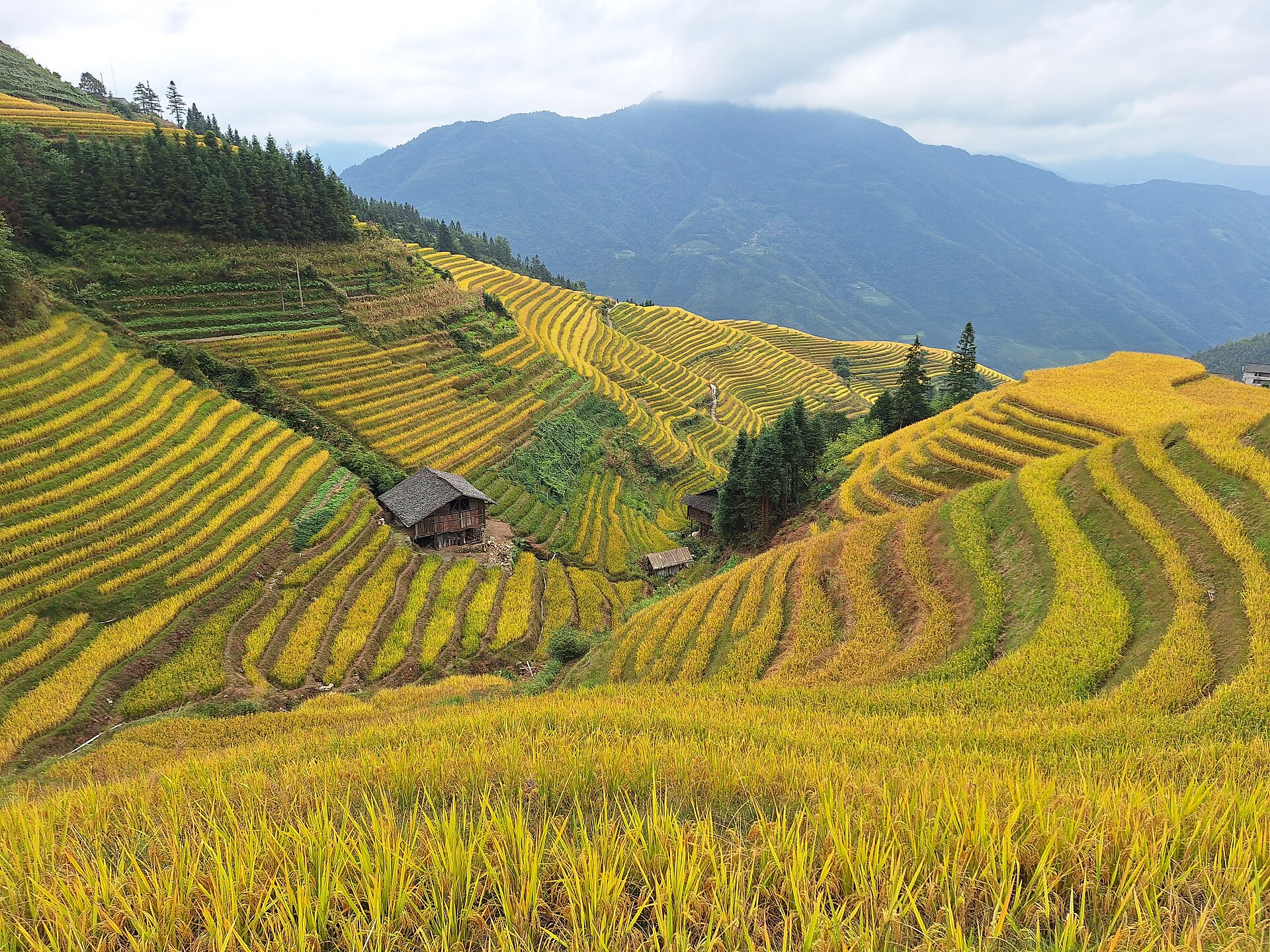
The ridge
Sixty-six square kilometres of paddy stacked between 300 and 1,100 metres, cut by Zhuang and Yao villages over six and a half centuries, and still farmed by hand and buffalo. The best two-day walk in the province.
Up to the terraces ↗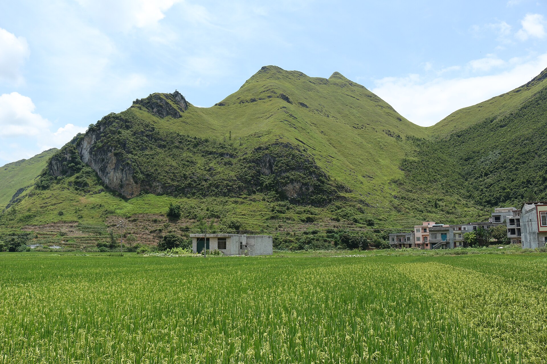
The collapse country
Twenty-eight tiankengs in a hundred square kilometres, the largest 613 metres deep with ten hectares of untouched forest on its floor. Caves that swallow rivers, and a natural stone bridge 165 metres high.
Into the far west ↗03 / Pick your month
Two dry windows and a subtropical summer.
The monsoon runs from May to September and decides the rivers, the rice and the roads. October is the best month of the year, and the mirror season on the terraces is a fortnight in May.
Open month Cold, closed or limited Best window
October – November · The best window
Dry, 20–28 °C, low green water on the Li, the terraces turning gold and dry rock in Yangshuo. Book the October holiday week or avoid it entirely, but do not improvise it.
March – April · Mist and green
Warm and green, with the low cloud that makes the towers look like a brush painting. The paddies are flooded, the rivers are clear and rising, and the crowds are thin until May Day.
May – September · The monsoon
Hot, humid and wet: 30–36 °C, brown rivers, afternoon storms and typhoons on the coast from July. The falls at Detian are at their widest, the caves are at their wettest, and the climbing day ends at eleven.
04 / Stay curious
One rock, four expressions.
Guangxi is not a province of big mountains — its highest point is 2,142 metres. It is a province of one rock, dissolved in four different ways, and each of them is a different trip.
- 01
Tower karst
Where the limestone is thick and deeply jointed, dissolution leaves isolated towers rising out of a flat plain. This is the Guilin and Yangshuo landscape, and it is why the climbing is vertical and the cycling is flat.
- 02
Peak clusters and terraces
Where the rock is thinner and the valleys have not widened, the result is a cluster of cones. The Longji terraces are cut into exactly this: 66 square kilometres of slope between 300 and 1,100 metres, farmed since the Yuan dynasty.
- 03
Collapse
Where a very large cave chamber loses its roof, the surface drops into it and leaves a tiankeng: sheer walls, a debris floor, and forest that has been isolated for long enough to be its own ecosystem. Leye has the densest cluster known.
- 04
The other rock
The coast is not karst at all. Weizhou is a young volcanic island of basalt and ash, with a breached crater at Nanwan and 95 per cent of its rock above the waterline volcanic. It is the only place in the province where the sea is the story.
05 / Go deeper
Four journeys, three bases.
The published Guangxi journeys all work out of the Guilin–Yangshuo–Longji triangle: a river float, a climbing week, a family climbing break and a six-day walk. The far west and the coast are built privately, because the transfers are long and the seasons do not align.
The most common planning mistake is to treat Guangxi as a small province and book four regions in a week. The second is to arrive in July expecting green water and dry rock.
06 / Before you go
The useful details.
In Guangxi the constraint is heat and water, not altitude. Nothing on a normal itinerary is high enough to matter.
Altitude is not the problem
The province tops out at 2,142 metres on Mao’er Shan. Guilin is 150, Yangshuo 110, the terraces 1,100, Leye 970 and Weizhou 79. There is no acclimatisation sequence to plan.
The river decides the day
High water stops the bamboo rafts and turns the Li brown; low water moves the cruise departure downstream. Check the level the day before, not the week before.
Book the mirror season early
The flooded terraces from mid-May to early June are the busiest fortnight at Longji, and the October holiday is the busiest week in the province. Both need accommodation months ahead.
Keep exploring
Go one layer deeper.
07 / Common questions
The questions that come up first.
What travellers ask before a Guangxi route takes shape.
01How many days does Guangxi need?
Six to eight for the Guilin–Yangshuo–Longji triangle, done properly. Ten to twelve to add either the far west or the coast. Two weeks for both wings, and that is a lot of driving.
02Is Guangxi good for a first climbing trip?
Yes — it is the best place in China for one. More than a thousand bolted routes, dozens of crags, bilingual guides, and easy lines within twenty minutes of town.
03When are the terraces at their best?
Mid-May to early June for the flooded mirrors, and mid-September to mid-October for the gold harvest. Both are about a fortnight; the mirror season is far busier.
04Do I need a permit for Leye?
For the viewpoints and show caves, no. For any cave beyond the marked routes, yes: a geopark permit and a certified guide, which we arrange. The rim paths are not all fenced.
05Can I visit the Vietnamese side at Detian?
Yes, in the cross-border cooperation zone, with a passport and a permit arranged on the day. It is a half-day addition rather than a reason to go.
06Is Weizhou worth the ferry?
If you want warm water, volcanic geology and two quiet days, yes. If you want beaches and resorts, the mainland coast does it better. Ferries cancel in typhoons.
07Is it too hot in summer?
It is 33–36 °C with high humidity, and the climbing day ends at eleven. It is workable if you plan around the middle of the day, and unpleasant if you do not.
08Do I need to worry about altitude?
No. The highest point in the province is 2,142 metres, and a normal itinerary never exceeds 1,100. Heat and water are the constraints.
Something not covered here? See how a private route is put together ↗ or send us your question ↗
Your Guangxi.
Tell us whether rock, river, terraces or the underground is the point, and which month you can travel. Those two answers choose the region, and the region is the whole decision.
Start my journey brief