Xi’an
The old capital on the plain: a Ming wall you can walk round, a Tang pagoda, and the best food street in the country. Base for everything in the middle.
 Start your enquiry
Destinations / Shaanxi
Eight hundred and seventy-eight kilometres from the Mu Us sand to the Han River, crossing three climates on the way: a loess plateau in the north, the plain of the old capitals in the middle, and a green river valley in the south that belongs to the Yangtze.
Explore the guide ↓Northwest China · the middle Yellow River
Shaanxi is 205,624 square kilometres arranged as a strip, 878 kilometres from north to south and no more than 517 wide. The strip matters, because the province crosses three climate belts on the way down: the north is temperate and semi-arid, the middle is warm-temperate and farmed, and the south is subtropical and wet. Travelling from Yulin to Hanzhong is not a regional variation. It is a change of country.
Two landforms do the dividing. In the north, the Loess Plateau — 82,200 square kilometres of it, 40 per cent of the province, at 900 to 1,900 metres, cut into gullies by rivers that carry the soil away. In the middle, the Guanzhong plain, 460 to 850 metres, 49,400 square kilometres, the “eight hundred li of Qin” where thirteen dynasties built their capitals. And across the whole middle of the province, the Qinling, which is not a mountain in the alpine sense but a wall: the line where the Yellow River basin ends and the Yangtze begins, and where the warm south stops.
That is the design problem this guide is built around. Xi’an sits on the plain at the northern foot of the Qinling; Huashan stands at the eastern end of the same range; the loess country is two hours north by rail; and the wet south is a four-hour drive through tunnels under the divide. You can see the whole province in nine days, but only if you accept that the middle is a hinge rather than a base.
Three belts, and the places that define each of them.
The old capital on the plain: a Ming wall you can walk round, a Tang pagoda, and the best food street in the country. Base for everything in the middle.
Three pits under a hangar roof east of the city: an unfinished army of life-size figures, buried for 2,200 years and dug up by farmers digging a well.
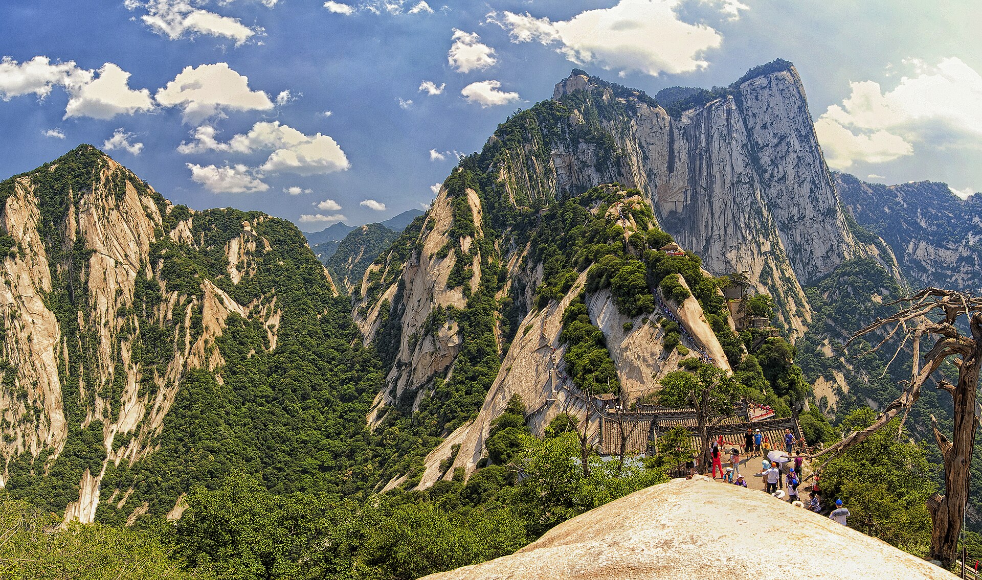
A single block of granite cut into five peaks, with a plank walk bolted to the south face and two cable cars to save your legs. The highest of the five sacred mountains.
The range that separates north from south in China, with the highest point in eastern China on its roof, alpine lakes in glacier bowls, and four endemic animals.
The Yellow River 300 metres wide, suddenly squeezed into a channel 50 metres across and dropped 30 metres into a slot. China’s second-largest waterfall.
The revolutionary capital in a landscape of loess ridges and cave houses, with the pagoda hill above the town and the war years preserved in concrete.
The Great Wall’s biggest beacon tower, the white rammed-earth capital of a Xiongnu khan, and a red sandstone valley that looks like a sea in motion.
A basin on the Han River with rice, tea and citrus, the last seven wild crested ibis in the world, and a plank road cut into the Qinling cliffs.
No fixed departure yet. These are the shapes we build in Shaanxi.
The Guanzhong three days, the Huashan two, the Qinling traverse, the northern loop and the southern run, with days and seasons on one page.
Where Huashan and the Qinling sit among the site’s other walking routes.
The full list of walking products, for comparing Shaanxi against Sichuan, Yunnan and the rest.
The reference pages for this province.
From 168.6 metres where the Han leaves the province to 3,771.2 on the roof of the Qinling, and what each band does to a walking day.
A dry cold north, a hot hazy plain, a wet green south, and three separate springs arriving six weeks apart.
The facts that move: Huashan crowds, the Hukou flood, the Qinling snow line and the rapeseed window.
Three springs, arriving six weeks apart.
The best window overall. The plain warms first, the Qinling foothills green up in April, and the loess is at its least dusty before the summer rain. Rapeseed in the Hanzhong basin peaks in the second half of March.
Hot on the plain — 35 degrees is normal in Xi’an — and the rainy season runs from July. Huashan and Taibai are 8 to 12 degrees cooler and are where everyone goes at weekends. The Yellow River is at its widest and loudest in July and August.
The clearest months, and the year’s best light on the Qinling. Early October is crowded everywhere; the last two weeks of October are the single best fortnight in the province.
Cold and dry, with coal-season haze on the plain. The Qinling passes close under snow and Taibai’s high route shuts. The upside: empty walls, empty pits, and Hukou’s ice season in January.
What changes from year to year in Shaanxi.
Crowd patterns, snow line, river flow and the rapeseed window, on one board.
Why the waterfall is a different object in April, August and January.
Fly into Xi’an, give the plain two days and the mountain two more, then decide whether to go north into the loess or south under the Qinling. Both are worth a week; neither is a day trip.
Start my journey brief ↗