Tongwancheng
The Xiongnu capital in rammed earth, 50 kilometres north of Jingbian. Corner tower, wall line, and a museum; the site is exposed and the wind is constant.
 Start your enquiry
Destinations / Shaanxi / Yulin
The northern edge: a Ming wall town at the margin of the Mu Us sand, the white rammed-earth capital of a Xiongnu khan, and a red sandstone valley that looks like a sea caught mid-motion.
Explore the guide ↓Northern Shaanxi · the desert edge
Yulin sits at the point where the loess plateau meets the Mu Us sand, on the line the Ming dynasty chose for its northern wall. For two thousand years this was the frontier — the boundary between the farming state and the steppe — and the archaeology of the district is a catalogue of that: a Xiongnu capital, a Ming beacon tower, and a stretch of wall that runs from the Yellow River to the desert.
The most surprising thing here is a city of white earth. Tongwancheng, 50 kilometres north of Jingbian, was built from 413 as the capital of the Xia state founded by the Xiongnu leader Helian Bobo. The walls were rammed earth stabilised with lime and glutinous rice, and they have survived 1,600 years of wind: the corner tower still stands eight storeys high, white against the sand, with the holes for its floor beams still in the wall.
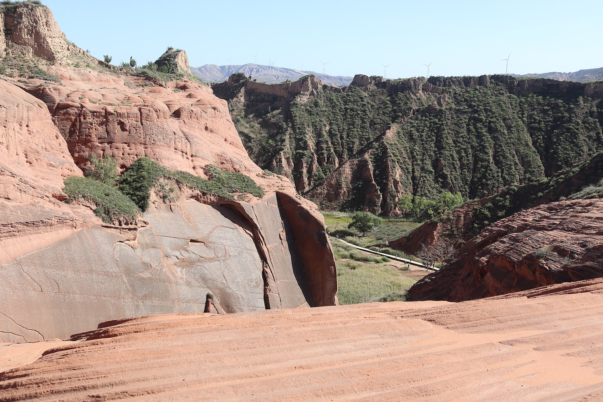
And then there is the geology. South of Jingbian, the Longzhou valley cuts through red sandstone laid down in the Jurassic, and water and wind have carved it into rippled slabs and fluted walls. The Chinese name for it is wave valley, and on a low sun the rock reads exactly like that. It is a national 4A scenic area now, with boardwalks, and it is still the strangest landscape in the province.
A dead capital, a beacon tower and a red valley.
The Xiongnu capital in rammed earth, 50 kilometres north of Jingbian. Corner tower, wall line, and a museum; the site is exposed and the wind is constant.
The Ming wall’s largest watchtower, 30 metres high on a hill north of Yulin, with 286 metres of base and four storeys of brick. The view is the wall running west into the sand.
Rippled Jurassic sandstone in the Longzhou valley, with boardwalks and a scenic-area ticket. Best in low sun, and best out of the middle of the day.
The section of wall that runs east to the Yellow River at Fugu, with earth ramparts, watchtowers and the occasional brick-faced stretch. Driven, not walked.
A large brackish lake on the Shaanxi–Inner Mongolia border, with sand dunes on its northern shore and a breeding colony of relict gulls.
A Ming grid of streets behind the south gate, with the drum tower, the old lanes and the food that goes with a frontier garrison town.
Late spring and early autumn, and not the windy weeks.
The best window: warm, dry, and the sand stable. The wave valley is at its most colourful after the spring rain.
Hot in the day, cool at night, with the summer storms that make the red rock vivid. The grasslands north of the wall are green and the lake is full.
Clear and dry with low sun and the best light on the sandstone. Cold at night; the first snow comes in late October.
Dust-storm season on the plateau. The light is bad, the wind is constant, and the wave valley loses its colour. Avoid if you can.
Two bases: Yulin and Jingbian.
Yulin is five hours from Xi’an by high-speed rail, or an hour by air. Jingbian is two hours further west by road.
Yulin for Zhenbeitai, the old town and the wall. One night is enough, two is comfortable.
Jingbian for Tongwancheng and the wave valley, which are on opposite sides of the county. Two nights, or one very long day.
This is a driving district. Distances are 50 to 100 kilometres between sites and the roads are good; there is no practical public-transport version.
Two thousand years of a line in the sand.
The Xiongnu leader who founded the Xia state in 407 and built Tongwancheng from 413, moving 100,000 people to do it. The name means “to rule ten thousand”, and the walls were inspected with an awl: if it went in an inch, the builder was executed and buried in the wall.
The wall through Yulin is part of the northern defence system built in the 15th and 16th centuries. Zhenbeitai was finished in 1608 and was as much a customs post for the horse trade as a fort.
The Mu Us has been moving for a thousand years and the wall has been buried by it more than once. The shelter belts planted since the 1950s are the reason the road north is not a desert road any more.
Wind, exposure and the ticket office.
Tongwancheng has no shade and the wind is relentless. This is a hat-and-sunscreen site, not a museum.
The wave valley is a ticketed scenic area with a shuttle; Tongwancheng has an entrance fee and a museum. Both can close after heavy rain.
The red rock needs low sun. First two hours and last two hours are the whole difference; midday is flat and the boardwalks are full.
Even in August the plateau drops to 10 degrees after dark. The temperature swing between noon and midnight is 15 degrees or more.
Two nights in Jingbian and one in Yulin: the white city at dawn, the wave valley at dusk, and the beacon tower on the way back. May or October, and a car.
Start my journey brief ↗