Taibai Shan
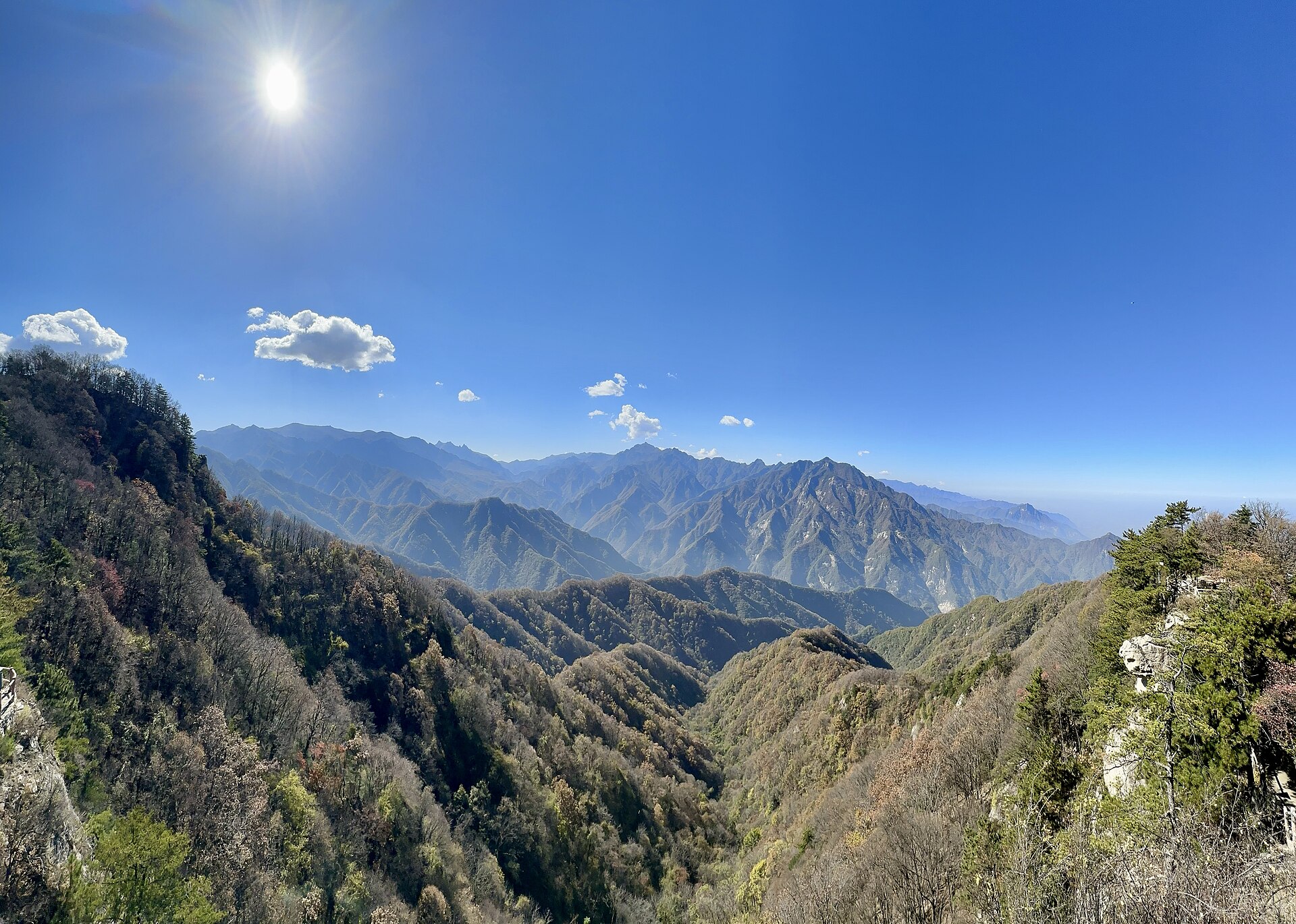
The main peak of the range and the highest point in eastern China, reached by cable car to 3,511 metres and then on foot. The summit is a rock platform with a temple and a view over the whole divide.
 Start your enquiry
Destinations / Shaanxi / The Qinling
A wall across the middle of China: the range that stops the warm south from going north, divides the Yellow River from the Yangtze, and carries the highest ground in eastern China on its roof at 3,771.2 metres.
Explore the guide ↓Central Shaanxi · the divide · 3,771.2 m
Every Chinese geography textbook has the same sentence: the Qinling and the Huai River together form the boundary between north and south. What that means on the ground is a range running east to west across the middle of the country, high enough and continuous enough to block the summer monsoon from moving north and the winter cold from moving south. South of it, rain-fed rice, tea, citrus and bamboo. North of it, wheat, millet, dry fields and dust.
In Shaanxi the range fills the southern half of the province. Its highest point is Taibai Shan, 3,771.2 metres at the peak called Baxiantai — the highest ground in eastern China, and high enough to carry the relics of the last glaciation: cirques, moraine, and a chain of small lakes at 3,500 metres and above, of which Daye Hai is the largest and best known.
The range is also the reason Shaanxi behaves like three provinces. Every road and railway from the Guanzhong plain to the Han River basin has to cross it, and until the tunnels were built in the 20th century that meant the plank roads — galleries of timber bolted to the cliff at Baohe and Shimen, some of which are still walkable. The Qinling is not scenery on the way to somewhere else. It is the thing that made the somewhere else different.
The roof, the lakes, the animals and the old roads.
The main peak of the range and the highest point in eastern China, reached by cable car to 3,511 metres and then on foot. The summit is a rock platform with a temple and a view over the whole divide.
The largest of the Taibai lakes, in a glacier-carved bowl below the summit, frozen from November to May. The hut beside it is the usual high camp.
The Qinling is the type locality for the giant panda’s northern subspecies, the crested ibis, the golden snub-nosed monkey and the takin. All four are resident; none is easy to see.
Timber galleries cut into the Qinling cliffs to carry the road from Guanzhong to Hanzhong, in use from the Han dynasty to the 20th century. Sections survive at Shimen and can be walked.
The range’s northern escarpment an hour south of Xi’an, where the foothills rise straight out of the plain. Day walks, temples and the Cui Hua mountain Geopark.
A network of national nature reserves on the southern slopes, protecting the largest wild panda population in the Qinling. Research stations, not visitor attractions; access is by arrangement.
May to October on the high route; all year in the foothills.
The best window for the summit: the snow has gone from the main route, the alpine meadows are green, and the haze has not yet arrived. Nights are still below freezing at 3,500 metres.
The rainy season. Warm, wet, and prone to afternoon storms on the ridge; the lakes are at their fullest and the waterfalls at their strongest. Leeches in the forest belt.
Clear, dry and cold at night, with the best visibility of the year and the larch turning on the upper slopes. The single best month for the traverse.
The high route closes under snow and the summit huts shut. The northern foothills stay walkable all winter; the passes are cleared but the side valleys are not.
Two days up and down, or four days across.
Xi’an to Taibai by road, cable car from Honghuaping at 2,280 metres to Tianyuan Difang at 3,511, then three to four hours on foot to the summit and the lakes. One long day, or sleep at Daye Hai.
A four-day walk from the north side to the south, hut to hut, crossing the main ridge above 3,000 metres. Serious mountain weather, no rescue infrastructure, and a permit arrangement that changes; we do not run it without a local guide.
Two and a half hours by road from Xi’an to the Taibai gate at Tangyu, plus 90 minutes of shuttle on the mountain road to the cable car. The last bus down leaves in the late afternoon.
The expressway and the 18-kilometre Zhongnanshan tunnel cut the old two-day crossing to two hours. The old plank roads at Shimen are a separate, walkable remnant of what it used to cost.
Why one range decides what people eat, grow and believe.
The Qinling approximates the January 0-degree isotherm and the 800-millimetre rainfall line, which is why the boundary between wheat and rice runs along it rather than along a provincial border.
The range is the southern boundary of the old Chinese world: the Han valley beyond it was frontier, and the plank roads were military engineering before they were trade routes.
The crested ibis was down to seven wild birds in 1981, all of them in one valley on the southern slope at Yangxian. The species still exists because of that valley, and because a county stopped using pesticide on its rice fields.
Altitude, weather and the limits of the map.
Taibai is 3,771 metres: mild altitude effects are normal, and the weather changes faster than the forecast. The cable car removes 1,200 metres of climbing, not the altitude.
Most of the range is national nature reserve. The summit route is open; the core panda habitat is not, and off-trail walking is prohibited rather than merely discouraged.
Above 3,000 metres there is one hut, no phone signal and no road. Everything you need for a night goes up with you.
The southern slopes get twice the rain of the northern ones, and the forest belt stays damp into June. Waterproofs are not optional in July and August.
One day to stand on the roof of eastern China by cable car and foot; four days to cross the range properly. Do the short version in late May or October, and the traverse only with a guide.
Start my journey brief ↗