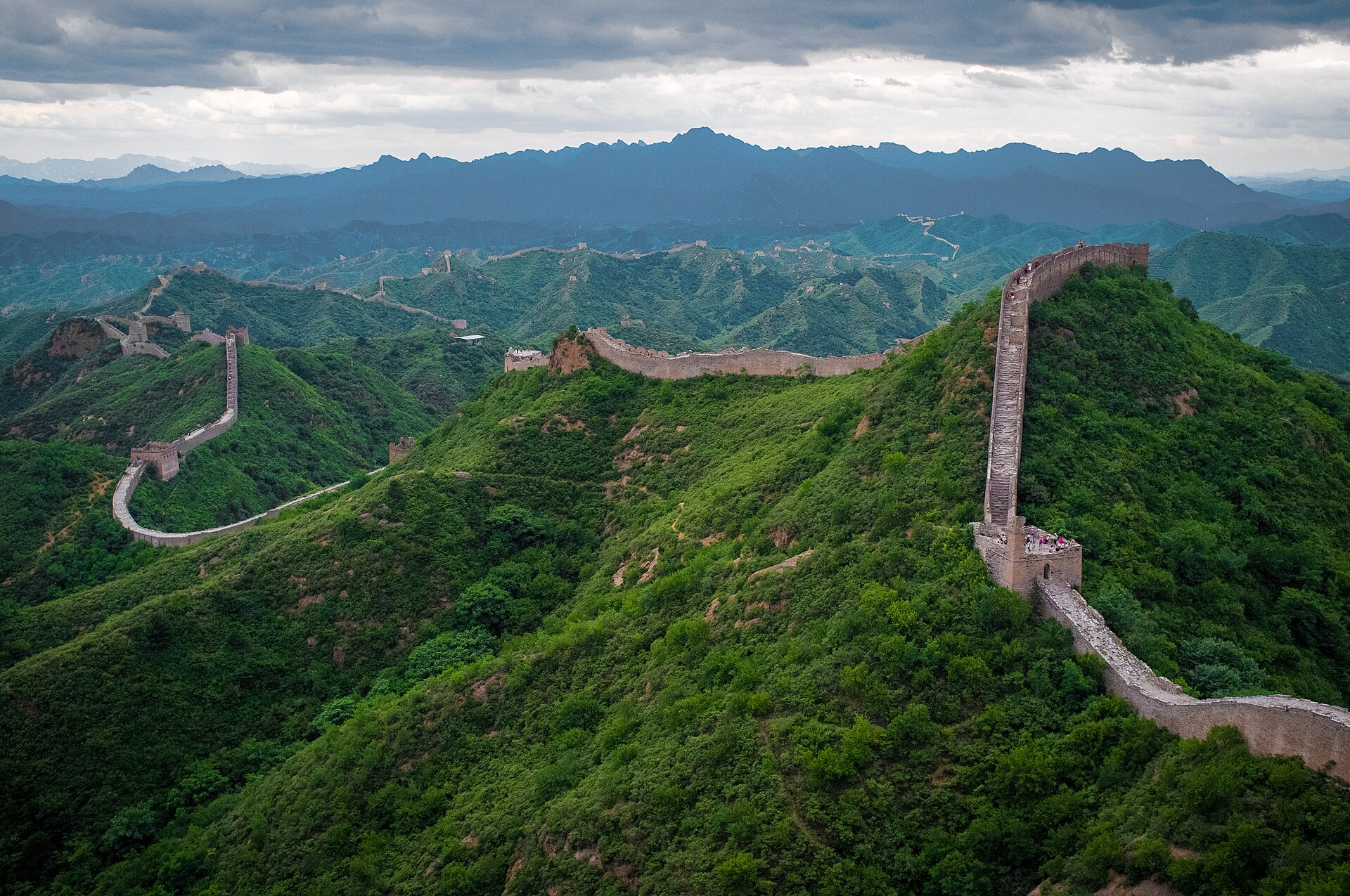
The Great Wall at Jinshanling
The best-preserved stretch of Ming wall in the country: 10.5 kilometres of it, 67 watchtowers, rebuilt by Qi Jiguang between 1567 and 1582 and never restored since.
 Start your enquiry
Destinations / Hebei
The one province with all six of China’s landforms — plateau, mountain, hill, plain, lake and sea — arranged as a ring around Beijing. Two thousand five hundred kilometres of wall run through it, and the coast is 487 kilometres long.
Explore the guide ↓North China · the Bohai shore
Hebei wraps around Beijing and Tianjin. That geography has decided most of its history: the passes north of the capital were the ones that mattered, the wall was built to hold them, and the province has spent six hundred years being the place an army came through. It is also why the province gets overlooked. Everyone passes through it; few stop.
The land falls from north-west to south-east in three steps. The Bashang plateau at 1,200 to 1,500 metres is the southern edge of the Mongolian plateau — cold, open, 15,954 square kilometres of it. Then the mountains: the Yanshan running east to west and the Taihang running north to south, meeting in the north-east corner, 48 per cent of the province, ten peaks above 2,000 metres, the highest at 2,882. Then the plain — 43 per cent of the province, mostly below 50 metres, wheat and maize and cities — running out to a 487-kilometre coast on the Bohai.
What that means for a route is that Hebei is a set of edges rather than a centre. The wall and the passes in the north, the marble peaks and the old temples in the west, the marsh and the plain in the middle, the sea in the east. This guide treats it that way: nine places on the rim of the ring, with Beijing in the hole in the middle.
The wall, the mountains, the summer capital, the plain and the sea.
The best-preserved stretch of Ming wall in the country: 10.5 kilometres of it, 67 watchtowers, rebuilt by Qi Jiguang between 1567 and 1582 and never restored since.
The pass Xu Da built in 1381 to close the road between the capital and Manchuria, and the old dragon’s head four kilometres south where the wall walks into the Bohai.
The northern end of the Taihang: a forest of white dolomite pillars above 2,000 metres, with the wall on the ridge below the summit and two glass walkways bolted to the cliffs.
The largest surviving imperial garden in the world — 5.64 square kilometres — and twelve frontier temples outside it, built to face the steppe in the languages of the steppe.
The southern rim of the Mongolian plateau: grassland, birch scrub, and the Saihanba forest, 1.15 million mu of larch and pine planted by hand since 1962.
A county town on the plain with one of the oldest working temples in China, a bronze Guanyin cast in 971, and four pagodas inside a square kilometre.
The oldest open-spandrel stone arch bridge in the world, built by Li Chun around 600 and still standing over the Jiao River: 64.4 metres long, one arch, four small ones above it.
The largest freshwater lake on the north China plain: 143 shallow basins joined by 3,700 channels, 12,000 hectares of reed, and a fishing economy older than the marsh’s fame.
Five summits on the highest massif in the province, a national nature reserve for brown eared pheasant, and the one place where you can walk from oak forest to alpine meadow in a day.
No fixed departure yet. These are the shapes we build in Hebei.
The wall week, the Chengde-and-Bashang loop, the plain and the marsh, the Taihang north end and the coast, with days and seasons on one page.
Where Jinshanling and the other walkable sections sit among the site’s walking routes.
The wider index of walking and temple routes, for comparing Hebei against Shanxi and Sichuan.
The reference pages for this province.
From sea level on the Bohai to 2,882 metres on the East Peak of Xiaowutai, and what the four bands do to a walking day.
A cold dry north, a hot hazy plain, a coast that opens in May, and the two weeks in October when all of it works.
The facts that move: wall-section closures, the Bashang grass, the Baiyangdian water level and the autumn colour.
Two good windows, and a coast that runs later than the mountains.
The best months overall. The plain is warm, the wall ridges are green, peach and pear are out on the Taihang slopes, and the Bashang is still brown but passable. April is windy; May is calmer.
Hot and humid on the plain — 33 to 36 degrees in Shijiazhuang — with the rainy season peaking in July and August. The coast is at its best and at its busiest; the Bashang runs 8 to 10 degrees cooler and is where the province goes on holiday.
The clear window. The haze lifts, the light is best on the wall, the larch on the Bashang turns gold in early October, and the sea stays swimmable into early September. October is the best month in the province.
Cold and dry: minus 10 to minus 20 on the Bashang, around zero on the plain, with coal-season haze in December and January. The wall is empty and the light is hard; mountain sections ice up and some close.
What changes from year to year in Hebei.
Wall closures, grass and colour on the plateau, the marsh water level, and the coast’s short season, on one board.
Why the larch turns in early October and what rain does to the steppe tracks.
Land in Beijing, walk Jinshanling on the first morning, then choose one direction: north to Chengde and the plateau, or east to the pass and the sea. Three days is a taste; a week is the province.
Start my journey brief ↗