The south Taihang
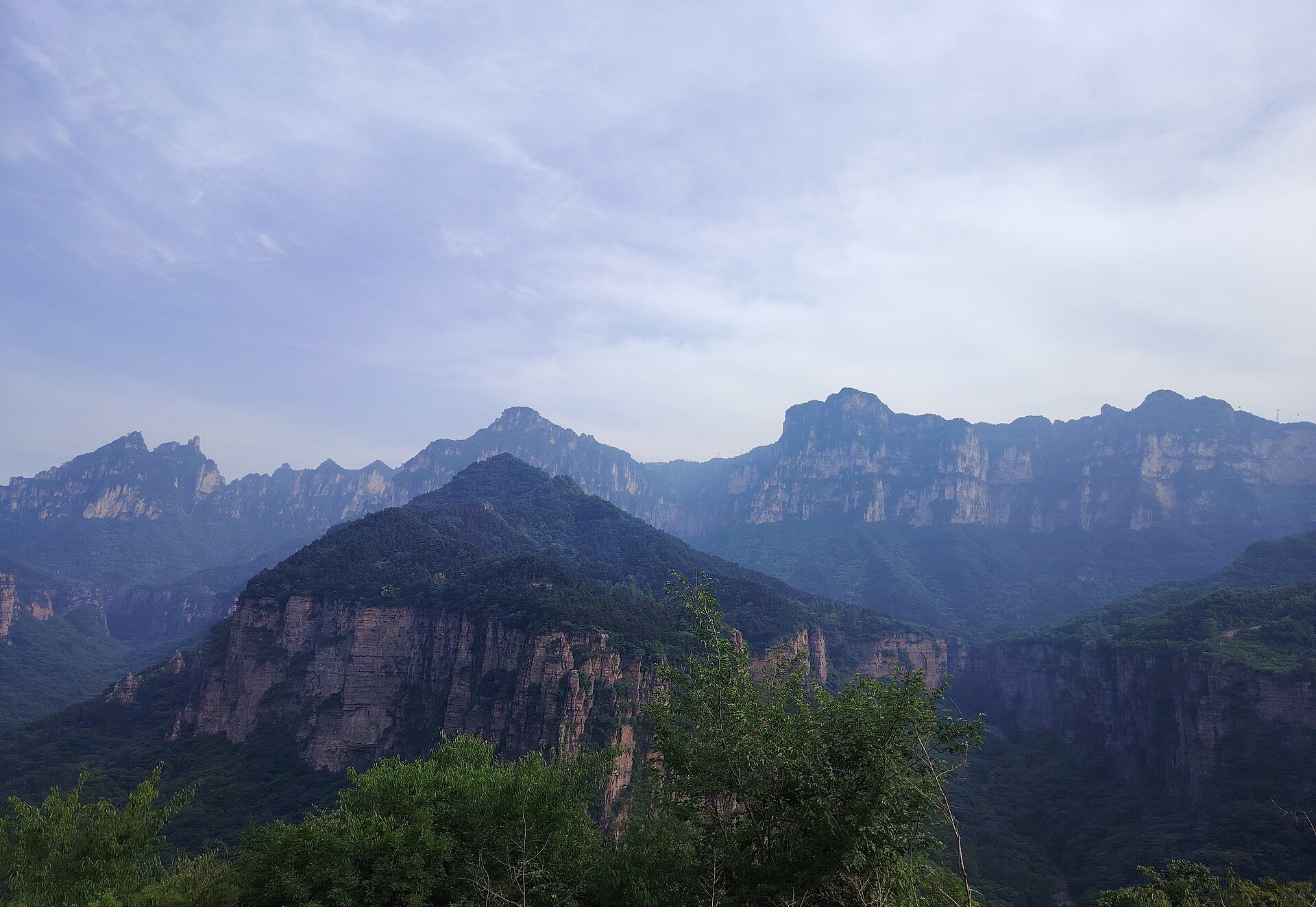
A fault scarp that drops a thousand metres onto the plain, with a thirty-kilometre road along the rim and a valley of waterfalls underneath it.
 Start your enquiry
Destinations / Henan
A wall of red rock in the north that people cut roads and canals through, a granite range in the west with a Taoist temple on its summit, and the one mountain in the middle of the plain that four dynasties treated as the centre of the world.
Explore the guide ↓Central China · the middle Yellow River
Henan is 167,000 square kilometres of the Yellow River’s middle plain, and about 44 per cent of it is mountain or hill — but the mountains are all at the edges, arranged in a half-ring along the north, the west and the south. The middle is flat, farmed and under 100 metres. Everything in this guide sits on the rim of that ring.
The north rim is the Taihang, and inside Henan it behaves like a wall rather than a range: a fault scarp that drops a thousand metres from a rim at 1,500 to 1,700 onto the plain. The west is the Funiu, a granite mass that reaches 2,217 metres on Laojun Mountain and divides the Yellow River basin from the Huai and the Yangtze. And between them, standing alone above the plain at 1,491.7 metres, is Songshan — the Central Mountain of the five sacred peaks, and the reason this province thinks of itself as the middle of China.
What separates Henan from the mountain provinces of the south-west is that almost none of it is wild. These cliffs have been quarried, terraced, tunnelled and farmed for two thousand years, and the two things the province is proudest of were both cut by hand into the same wall of rock: a 1,250-metre road tunnel at Guoliang, and a 1,500-kilometre canal along the Taihang face. The days here are vertical and human-scale, and the engineering is part of the landscape.
Three mountain systems, and the three things people cut into them.
A fault scarp that drops a thousand metres onto the plain, with a thirty-kilometre road along the rim and a valley of waterfalls underneath it.
A village on a cliff top, and the tunnel five years of hammering put through the rock beneath it. Thirty-five windows, one lane, no machinery.
The other thing cut into the same cliffs: a canal hung along the Taihang face to carry water from Shanxi into a county that had none.
A red quartz gorge 1.5 kilometres long and 86 metres deep, a single waterfall of 314 metres, and a summit at 1,308 that a Tang poet made famous.
The Central Sacred Mountain: 72 peaks, a plank road on the Shaoshi cliffs, and eight clusters of buildings that UNESCO listed in 2010.
The highest of the Funiu peaks, with a forest of granite towers that leans downhill and a group of gold-roofed temples on the top.
No fixed departure yet. These are the shapes we build in Henan.
The Taihang hand-cut week, the two-mountain traverse, the sacred-mountain line and the plain add-on, with days and seasons on one page.
Where Songshan and Shaolin sit among the site’s other cultural walking routes.
The full list of walking products, for comparing Henan against Sichuan, Yunnan and the rest.
The reference pages for this province.
Three hundred and fourteen metres of falling water, what feeds it, and what happens to it in February.
From 23 metres at the Huai River to 2,414 in the Xiaoqinling. Why nothing here needs acclimatisation and everything needs knees.
A dry spring, a wet July, a superb October, and the holiday weeks that fill the cliff roads.
The handful of facts that move every year, in one place.
A dry spring, a wet July, and an autumn worth waiting for.
The best all-round window: dry, warming, and green returning to the cliffs. Late April is peony season in Luoyang, which is a reason on its own.
The rains arrive in July and the humidity is high on the plain. The canyons run full, which is what you want at Yuntai and Guoliang, and the mountains are 8 to 10 degrees cooler than the cities.
The clearest months and the best light. October is the single best month in the province: dry air, low sun, and the Taihang rim at its most legible.
Cold, dry and often hazy on the plain. Snow on the Taihang rim closes sections of the cliff roads; the temples and the museum are at their emptiest.
What changes from year to year in Henan.
Rain, snow line, waterfall flow and the holiday calendar, on one board.
Why the 314-metre fall at Yuntai is a seasonal object, and when to expect it at strength.
Twelve months across the Taihang, the Funiu and the central mountain.
Tell us whether you want the cliffs or the temples, and how much of the week you are willing to spend in a car. In Henan the two mountain systems are four hours apart, so the answer decides the shape.
Start my journey brief ↗