Qingnian Tunnel
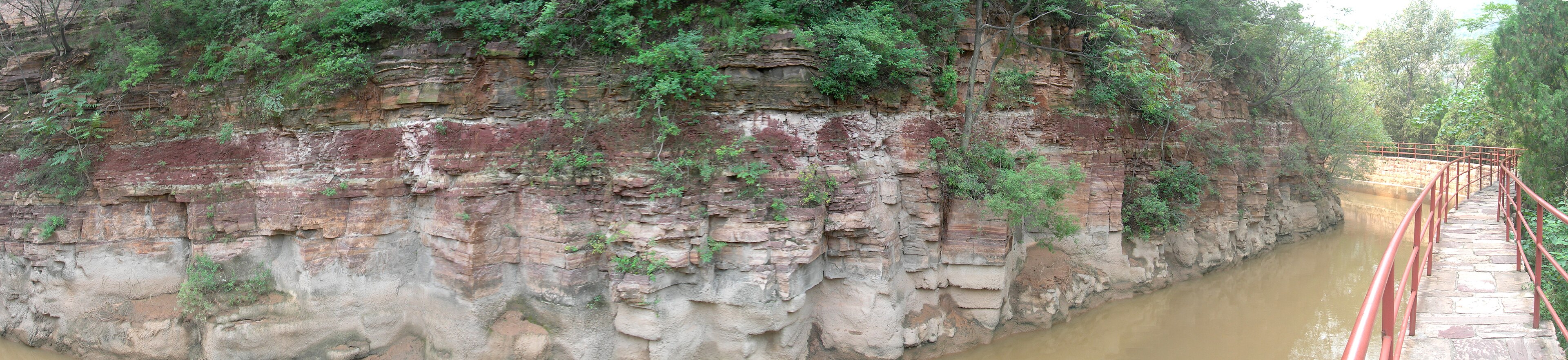
The stretch where the canal had to be cut through a promontory above the river, named for the youth brigades who did it. The most-visited part of the canal, and the best place to see the channel, the cliff and the drop in one frame.
 Start your enquiry
Destinations / Henan / The Red Flag Canal
Fifteen hundred kilometres of water channel, hung along the side of the Taihang cliffs, built by hand between 1960 and 1969 to carry water from Shanxi into a county that had none.
Explore the guide ↓Northern Henan · Linzhou · 1960 – 69
Linzhou sits in the rain shadow of the Taihang. The mountains take the moisture out of the Pacific air before it reaches the county, and for five centuries the local records are a catalogue of drought: from 1436 to 1949, more than a hundred natural disasters and thirty years of total crop failure. The county had four rivers and about 12,000 mu of irrigated land out of 985,000 — roughly one field in eighty.
In 1959 all four rivers dried up. The county’s reservoirs were empty, the wells were failing, and the only reliable water left was the Zhuozhang River on the other side of the mountains, in Shanxi. The decision taken that winter was to take it: a canal from a dam at Houbi in Pingshan county, running along the cliff face, contour by contour, until it reached Linzhou. The county had 3 million yuan, 28 qualified water engineers, and about 100,000 people willing to work for food.
They finished ten years later. The main canal runs 70.6 kilometres from the intake to the dividing point; with the branches, the whole system is about 1,500 kilometres. Along the way it flattened 1,250 hills, dug 211 tunnels and built 151 aqueducts and more than 12,000 other structures, moving 22 million cubic metres of rock and earth. Eighty-one people died doing it. The irrigated area went from 12,000 mu to 540,000.
The hardest section, the dividing point and the record of it.
The stretch where the canal had to be cut through a promontory above the river, named for the youth brigades who did it. The most-visited part of the canal, and the best place to see the channel, the cliff and the drop in one frame.
Where the main canal splits into three branches and drops into the plain. The engineering is modest; the scale of what feeds it is not.
Photographs, tools, and the accounting of the ten years: the hammers, the rope, the home-made cement, and the names of the dead. Hard-edged and worth an hour.
The dam on the Zhuozhang just inside Shanxi, where the water leaves the river and enters the canal. Reached by road, rarely visited, and the true beginning of the story.
A working canal, in every season.
The best walking weather along the channel: dry, warm, and the terraces below the canal green. The cliff face is in shade for part of the morning.
Hot, and the canal carries its heaviest water. The Zhuozhang floods, the channel runs brown, and the cliff paths are slippery after rain.
Clear and dry, with the best light on the sandstone. October is the busiest month at the memorial and the tunnel.
Cold, quiet, and occasionally iced where the channel runs in shade. The canal still flows; the visitor sections are almost empty.
Linzhou is the base, and everything is within an hour of it.
Anyang East by high-speed rail, then an hour by road to Linzhou. The canal, the memorial and the Taihang canyon are all on the same side of the county, which makes a two-day combination easy.
The Red Flag Canal and the Linzhou canyon are twenty minutes apart. Most itineraries do the canal in a morning and the canyon in the afternoon, or give each a day.
Half a day for the tunnel, the channel walk and the memorial. A full day adds the intake and the branch canals out on the plain, which is where the system actually delivers its water.
What ten years of hand-cutting cost.
The engineer who surveyed the line, aged 27. He lost his mother and then his wife during the work, and was killed in March 1960 when the roof of the Wangjiazhuang tunnel collapsed on him. The canal’s measured gradient — a fall of one metre in eight thousand — is his.
The official figure for deaths across the ten years, from falls, blasts and roof collapses. The youngest was seventeen. The memorial lists them by name, which is the part that stays with you.
The four-character formulation that came out of the project — self-reliance, hard struggle, cooperation, no repayment sought — became a national slogan, and the canal became a school-trip destination. It is possible to find the politics tiresome and the engineering extraordinary at the same time.
A working channel, not a trail.
This is live irrigation infrastructure, not a monument. Walk beside it, not in it, and expect maintenance closures on sections after heavy rain.
The accessible stretch around Qingnian Tunnel is a few hundred metres of channel and cliff. The scale of the system is a map fact rather than a view.
The canal makes most sense on the same day as the Taihang cliffs it is cut into. Alone, it is an hour of walking and a museum; together, it is a day about what people do to a wall of stone.
Tell us whether the engineering or the walking matters more, and whether you are combining it with the canyon. The canal is a half-day and a good one, but it is not a mountain.
Start my journey brief ↗