Taohua Valley
The waterfall valley: a gorge inside the gorge, climbing nearly a kilometre in three and a half kilometres past nine connected falls and a series of green pools. The most popular walk in the park, and worth starting at opening.
 Start your enquiry
Destinations / Henan / The south Taihang
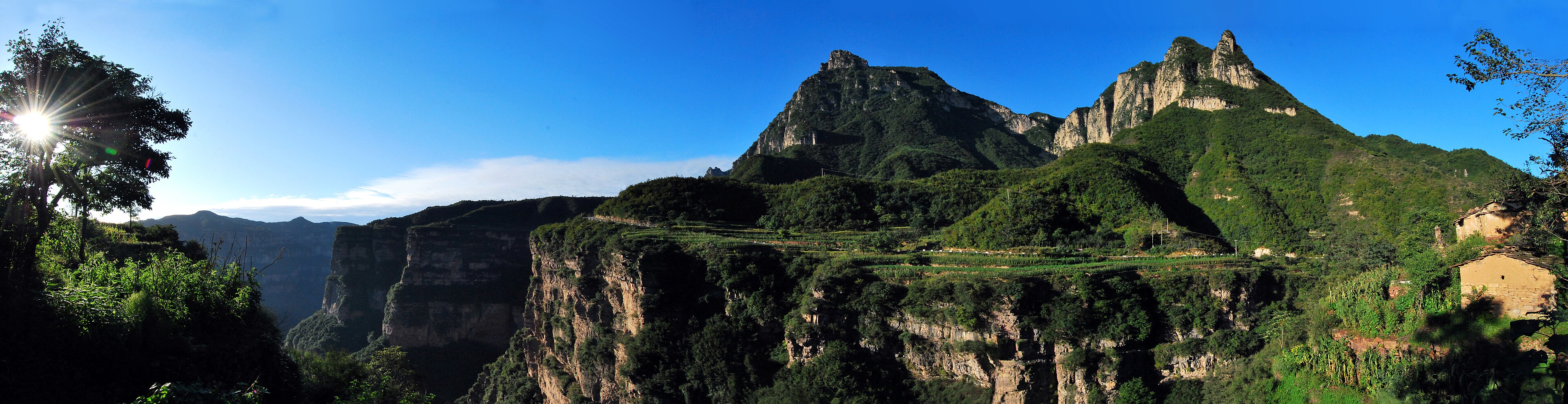
A fault scarp a thousand metres high, running along the north edge of the province, with a road along the rim, a valley of waterfalls under it, and a village built out of the rock in between.
Explore the guide ↓Northern Henan · Linzhou · 800 – 1,739 m
Most mountain ranges rise in the middle and fall away on both sides. The Taihang does not: it is a fault block, and along its eastern edge it simply stops, dropping from a rim at 1,500 to 1,700 metres onto a plain at 300. Eight hundred li of it — around 400 kilometres — runs from the Yellow River in the south to Beijing in the north, and the section inside Henan is the part where the drop is cleanest.
The Linzhou canyon is the centre of it. Fifty kilometres north to south and barely 1.5 wide, with a floor at 800 metres and a rim at 1,739, it drains east through a series of gorges into the plain. Inside 89 square kilometres there are three distinct things to do: a waterfall valley you walk up, a rim road you drive along, and a cliff face you climb beside.
The other thing to understand is that this is a worked landscape. The villages are built of the local slate, roofed with it, paved with it. The roads are cut into the cliff rather than laid over it. The water is seasonal and the farmers have terraced right up to the rim. Nothing here is untouched, and that is the point: it is a mountain that people have been living on, in a hard way, for a very long time.
The valley, the rim road, the cliff and the stone town.
The waterfall valley: a gorge inside the gorge, climbing nearly a kilometre in three and a half kilometres past nine connected falls and a series of green pools. The most popular walk in the park, and worth starting at opening.
A road along the top of the escarpment from Taohua Valley south to Xianxia Valley, with viewpoints that look straight down a thousand metres onto the canyon floor. Driven by shuttle; the walking is at the stops.
A natural amphitheatre of cliff with a vertical steel ladder of 88 metres bolted to the rock, a plank walkway under a hundred-metre wall, and a waterfall that drops more than fifty. The most exposed hour in the park.
The village at the bottom of the canyon, built entirely of local slate: walls, roofs, streets, steps. It has become an art-school base, which means cheap beds and a lot of easels in October.
Water in summer, colour in October, ice in between.
The best all-round window: green, cool on the rim, and the falls running from snowmelt and spring rain. The valley is at its least crowded before the May holiday.
The rains. The waterfalls are at full volume, the canyon is dramatic, and afternoon thunderstorms close the exposed sections. Hot and humid on the floor, pleasant on the rim.
The best month, and the busiest. Clear air, low sun, and the deciduous cover on the rim turning through late October.
Cold and quiet. Ice on the plank walkways and the upper road, some closures after snow, and a very austere version of the canyon.
Anyang in, Linzhou through, Shibanyan at the bottom.
Anyang East is on the Beijing–Guangzhou high-speed line: about an hour from Zhengzhou, two from Beijing. Linzhou is an hour west by road, and Shibanyan another forty minutes up the canyon.
One ticket covers Taohua Valley, the Sky Road and Wangxiang Cliff, and is valid for two days. Private cars stop at the gate; shuttles run between the zones and along the rim.
Two days is right. One day for the valley and the rim road, one for Wangxiang Cliff and Shibanyan. A single day means choosing between the valley and the cliff.
A wall that has always been a problem to cross.
Cao Cao crossed these mountains on campaign in the winter of 206 and left the line that every later traveller quotes: “Going north over Taihang, how steep, how high.” The road he complained about is roughly where the modern one runs.
The story of the Foolish Old Man who moved the mountain is set in this country — the Taihang and the Wangwu, with the rubble going to the sea. It reads differently once you have seen what a cubic metre of Taihang rock weighs.
Shibanyan means slate rock, and the whole town is a demonstration of what the cliff is made of: thin-bedded sandstone that splits into roofing, flooring and walling. Ask for the older houses; the new ones use concrete behind the slate.
Exposure, one-way paths and the state of the water.
It is driven, not walked. The viewpoints are short walks from the stops, and the section between them is a narrow road with a drop on one side. If that is not for you, the valley is the alternative.
Taohua Valley and the Wangxiang walkway both run one way in high season. That decides where you start, and it means a missed turning costs an hour rather than a minute.
The falls depend on rain and snowmelt. In a dry spring the nine falls of Taohua Valley can be nine trickles. Ask before you build a day around the water, and value the rock on its own terms.
Tell us whether you want the rim or the valley, and whether the 88-metre ladder is a reason or a warning. The canyon is built around that answer.
Start my journey brief ↗