The dam at Sandouping
The project viewed from the north bank: the spillway section, the 32 turbine halls, the five-tier double locks on the left bank and the ship lift that takes a 3,000-tonne vessel up 113 metres in about half an hour.
 Start your enquiry
Destinations / Hubei / The Three Gorges
A hundred and ninety-three kilometres of river between limestone walls, with the largest dam in the world sitting in the middle of the last and longest of them.
Explore the guide ↓Western Hubei · Yichang & Zigui
The Three Gorges run 193 kilometres from Baidicheng in Chongqing to Nanjianguan at Yichang: Qutang for eight kilometres, Wu for 45, and Xiling for 76. Only Xiling is inside Hubei, and it is the longest of the three, running from the mouth of the Xiangxi to the gorge gate at Yichang with the dam at Sandouping roughly in its middle.
The river here has cut through the Wushan range rather than going round it, which is why the walls are 1,000 metres above the water and the channel is narrow. In 1994 construction began on the dam that would raise the water behind it by more than 100 metres, relocate 1.3 million people, and turn the gorge into the upper end of a 600-kilometre reservoir. The dam is 2,309 metres along the crest, 185 metres above sea level at the top, and holds 39.3 billion cubic metres at the normal pool of 175 metres.
What that did to the landscape is more interesting than the usual argument about it. The narrowest, steepest sections still read as gorges, because the walls are so high that 100 metres of extra water is a small fraction of the section. The wide reaches between them now look like a lake. The old towns are gone; the tributary gorges — Shennong Stream, the Lesser Three Gorges — are still there and still worth the detour.
The dam, the gorge, the locks and the tributaries.
The project viewed from the north bank: the spillway section, the 32 turbine halls, the five-tier double locks on the left bank and the ship lift that takes a 3,000-tonne vessel up 113 metres in about half an hour.
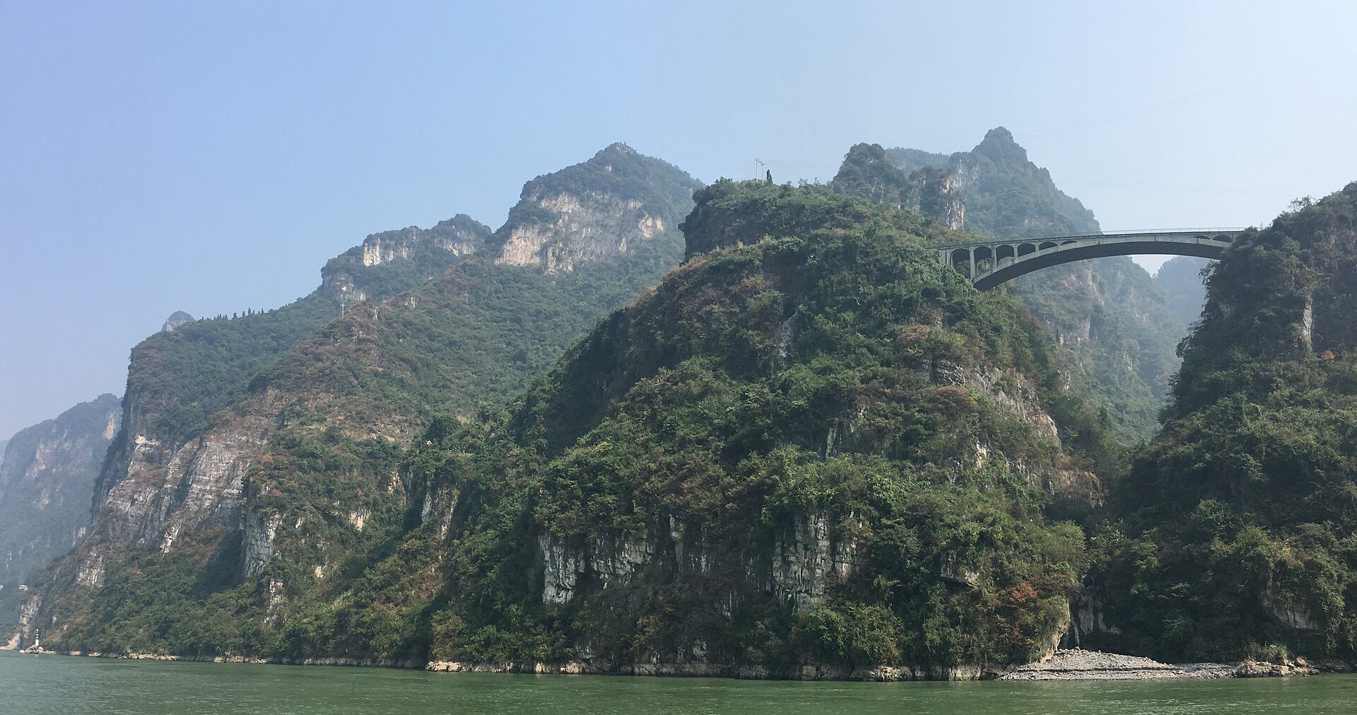
The gorge itself, from the deck: Huangniu and Dengying reaches, the cliff inscriptions, and the point where the reservoir begins to look like a river again.
A vertical lift for smaller vessels and a five-stage staircase for everything else. Watching a 10,000-tonne convoy descend 100 metres in five steps is the best free hour in Yichang.
The side valleys that the main river drowned least: narrow, clear, and navigated by small boats. The best way to see what the main gorge looked like before 2003.
Two water levels, and the best light in autumn.
The reservoir at its highest and the air at its clearest. The classic window for the gorge, and the time the red leaves come down to the water.
Cold, misty, quiet, and the water still high. The gorge looks its most painted and the boats are half empty.
The drawdown begins: the level falls towards the flood limit and the banks are exposed. Green on the walls, and good light.
Flood season. The reservoir is held at 145 metres, the tributaries are brown, and the dam releases. Dramatic, hot, and not the postcard.
Yichang is the hinge, and everything runs from it.
Yichang has an airport and high-speed rail from Wuhan in about two hours, plus the line west to Enshi. The dam is an hour from the city; the gorge gate is at the city edge.
The long Chongqing–Yichang cruises run three to four nights and pass the locks at night as often as by day. Day boats from Yichang cover the Xiling reaches and the dam in one long day.
Yichang for the dam and the locks; Zigui or Sandouping for an early start on the water; on the boat if you are doing the full transit.
What was moved, what was lost, and what was rebuilt.
Roughly 1.3 million people were moved for the reservoir, along with entire towns: Zigui was rebuilt up the slope, and the old county seats are under water. The new towns are functional and, architecturally, not the point.
The Zhang Fei temple, the Dongshan temple and a set of cliff inscriptions were relocated above the new water line. Qu Yuan’s shrine at Zigui was rebuilt on the point above the town.
This is the most written-about stretch of river in Chinese literature: Li Bai downstream, Du Fu upstream, and a body of verse that assumes the gorge as a moral landscape. Reading two or three of the poems before you go changes what you see.
Water level, timing and the scale of the thing.
The reservoir runs between 145 metres in flood season and 175 in winter. That 30-metre range decides whether the banks are walkable, whether the tributary boats run, and what the photographs look like.
The visitor area is a bus circuit with three stops and a security check. Allow three hours, bring your passport, and do not expect to walk on the crest.
A full downstream transit takes four days and ends in Yichang. A day boat out of Yichang is a there-and-back and covers less. Choose before you book, because they are different trips.
Tell us whether you want to transit the locks or stand beside the dam, and how many nights you will give the water. The answer decides whether this is a cruise or a day trip.
Start my journey brief ↗