Qiyuezhai & the cliff walkway
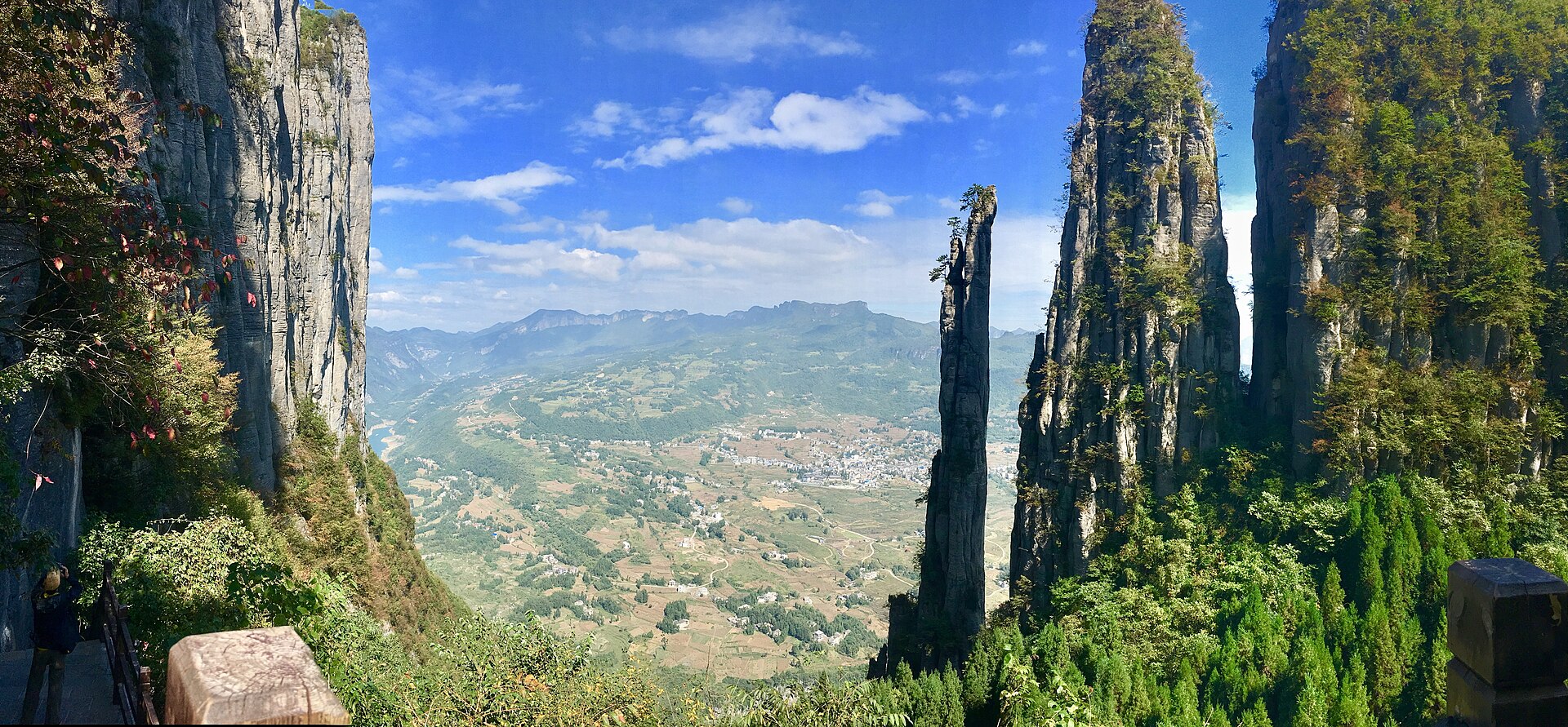
The upper canyon: a loop of about 7.5 kilometres along the rim, past the pillar, with a 488-metre walkway bolted to a vertical wall at roughly 1,700 metres. Cable car up, stairs down, or the reverse.
 Start your enquiry
Destinations / Hubei / Enshi
A hundred and eight kilometres of limestone canyon, a fissure with waterfalls inside it, and a stone pillar 150 metres high that has stood on its own base for longer than anyone has been counting.
Explore the guide ↓South-west Hubei · 1,500 – 1,900 m on the rim
The Enshi Grand Canyon runs about 108 kilometres across the south-west corner of Hubei, and covers something over 300 square kilometres. It is not a canyon in the Colorado sense — there is no single river at the bottom of a single trench. It is a karst plateau that has been dissolved into towers, with a river system underneath it, and the result is a landscape of cliffs standing above green floors, connected by a fissure that you can walk through.
The shape is Triassic limestone, laid down flat, then lifted and cut. Because the bedding is horizontal and the rock is strong — around 800 kilograms per square centimetre in compression — the towers hold their vertical faces for a long time. Yizhuxiang, the Incense Stick, is the extreme case: 150 metres of free-standing pillar, six metres across at the base and four at its narrowest, still standing because its centre of gravity sits low and nothing has undercut it.
The province calls this the world’s only place where a fissure, a tiankeng and a pillar field occur together, which is a claim worth treating as marketing rather than geology. What is certain is that the combination makes for an unusually varied two days: rim, slot, and a great many stairs.
The rim, the fissure, the clear gorge and the old Tusi capital.
The upper canyon: a loop of about 7.5 kilometres along the rim, past the pillar, with a 488-metre walkway bolted to a vertical wall at roughly 1,700 metres. Cable car up, stairs down, or the reverse.
A slot canyon at the bottom of the system, in places three metres wide and 75 deep on average, with a river running through it and waterfalls coming off the walls. U-shaped in section, which is rare, and walked on a boardwalk.
Two and a half hours south-east of Enshi city: an 18-kilometre gorge whose narrowest point is about 1.5 metres, where the water is clear enough that a boat appears to float in air. Reached by a long stair descent and a short boat leg.
A small mountain city with the prefecture museum and a reconstructed Tusi city in town; Tangya, the excavated seat of a chieftaincy, lies south-west at Xianfeng and has been on the World Heritage list since 2015.
Green from April, wet in June, clear in October.
The best combination: green returning, waterfalls running, and temperatures that make the stairs bearable. The canyon is at its least crowded before the May holidays.
The plum rain. The fissure is at its most dramatic and the water at its least clear; the cliff paths can close in thunder. This is the season to build in a spare day.
Hot on the plain, cool on the rim — Enshi markets a summer average near 22 degrees, which is why July and August are the busiest months of its year.
The best light and the most reliable weather, with October the peak. The canyon holds mist in the mornings and clears by mid-morning.
One city, two bases, one canyon gate 49 kilometres out.
Enshi has an airport and a railway station on the Yichang–Wanzhou line, with direct trains from Wuhan in roughly four and a half hours. The canyon gate is 49 kilometres north-west of the city.
Enshi city for the canyon and the museum; Hefeng for Pingshan, which is a separate day and a separate drive. Do not try to do both from one hotel.
Qiyuezhai is a one-way loop served by a cable car at the top and stairs at the bottom; Yunlong fissure is a there-and-back boardwalk. Most people do the rim in the morning and the fissure in the afternoon.
A prefecture, a chieftaincy, and a name made of two halves.
Enshi is a Tujia and Miao autonomous prefecture, and the Tujia are the majority in the countryside: a distinct language in the Sino-Tibetan family, now spoken fluently by very few.
For four and a half centuries, from the Yuan to the 1730s, the imperial state ruled these mountains through hereditary native chieftains. Rongmei, at Hefeng, was the richest of them — the Yongzheng emperor called it the wealthiest of all the chieftaincies of Chu and Shu. The system was abolished in 1735 and the sites are what is left.
The place was Shi for twelve centuries before it was Enshi. A prefecture of that name was set up in 573 for a local chief who had submitted to the Northern Zhou, and it outlasted the dynasties that made it. In 1729 the Yongzheng emperor raised the garrison to a county and put his own grace in front of the name — en, favour bestowed. The second half of the name is three hundred years old; the first is fourteen.
Stairs, closures and the state of the water.
Qiyuezhai is 7.5 kilometres with a long stair descent; Pingshan involves 700 to 1,900 steps depending on the route and the entrance in use. Neither is step-free, and knees are the limiting factor.
The clear-water gorge has a history of closures — for weather, for water level, for upgrading — and reopened on new terms more than once. Get a dated confirmation before you build a day around it.
Rain turns the gorge green-brown within a day. The floating-boat photograph needs dry weather, low flow and direct sun; plan for the picture, not around it.
Tell us whether the canyon or the clear-water gorge matters more, and whether you can take 700 steps down. Those two answers decide which side of the prefecture you sleep on.
Start my journey brief ↗