The Qingjiang gallery
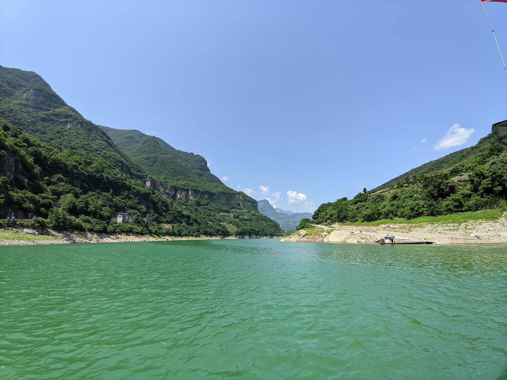
The 5A stretch above Geheyan: a boat route through the Daoying and Xianren reaches, where the water is still enough to double the cliffs. The single most popular thing to do on the river, and worth the early boat.
 Start your enquiry
Destinations / Hubei / The Qingjiang
Four hundred and twenty-three kilometres of river, the second in Hubei, running from a cave in Lichuan to the Yangtze at Yidu — and the one in the province you travel on rather than beside.
Explore the guide ↓South-west Hubei · Changyang & Yidu
In a province whose big river runs brown, the Qingjiang runs green. It drains karst rather than loess — low sediment, high clarity, and a colour that moves from jade to bottle green with the light. It rises on the eastern flank of Qiyue mountain in Lichuan, disappears underground for the first 16.8 kilometres of its course, and then runs east through Enshi, Jianshi, Badong, Changyang and Yidu, where it joins the Yangtze. Four hundred and twenty-three kilometres, 16,700 square kilometres of basin, and a fall of 1,430 metres.
That fall is why the river is dammed three times. Geheyan, at Changyang, was built between 1987 and 1996: a 151-metre arch-gravity dam holding 3.45 billion cubic metres, with a 300-tonne ship lift alongside it. Shuibuya, upstream, is a 233-metre concrete-faced rockfill dam — the highest of its type in the world. Gaobaizhou, at the mouth, re-regulates what the other two release. Between them they turned a river of rapids and shoals into a chain of long, still reservoirs.
For the traveller this is the gentlest landscape in Hubei and the easiest to underestimate. The water is calm, the boats are comfortable, and the gorges — Banxia, Bashan, Pingluo — are quietly spectacular rather than dramatic. It is a river to move slowly on.
The gallery, the dam, the old villages and the ancestral mountain.
The 5A stretch above Geheyan: a boat route through the Daoying and Xianren reaches, where the water is still enough to double the cliffs. The single most popular thing to do on the river, and worth the early boat.
The dam that made the gallery: an arch-gravity structure in an asymmetric valley, with a two-stage vertical ship lift for 300-tonne vessels. Seen from the water below, it is the most impressive piece of engineering in western Hubei after the Three Gorges.
Timber houses on stone plinths, terraces up the side valleys, and the small towns along the reservoirs. This is where the Tujia material culture is actually intact, rather than performed.
An island in the Geheyan reservoir, sacred to the Tujia as the place where the Ba ancestor Lin Jun is said to have won his chieftaincy. A short climb, a temple, and a view down the reservoir.
Dry season for clarity, summer for volume.
The clearest water of the year, when the reservoirs are full and the inflow is low. Cold, often misty, and the best months for colour.
Warm, green, and the water still reasonably clear before the rains. The best all-round window for boating and village walking.
The flood season: high water, brown tributaries, and the dams releasing. Dramatic, and the worst time for the postcard colour.
The reservoir at its highest after the autumn refill, with dry air and low sun. The single best month on the river.
Yichang in, Changyang along, Yidu out.
Yichang is the gateway, about two hours from Wuhan by high-speed train, and Changyang is an hour west of it by road. The gallery boats leave from the Changyang wharf.
A gallery cruise is three to four hours. Add the dam, a village lunch and Wuluo Zhongli and it becomes a full day with a night in Changyang rather than Yichang.
The river runs on to Enshi, but the road is slow and the three dams turn the upper course into a chain of still water. Above Changyang it is narrower, quieter, and very little travelled by boat.
A river with a founding myth.
The Ba ancestor who, in the Han histories, won the leadership of five clans by throwing a sword into a rock and steering a clay boat through the current. The story is set at Wuluo Zhongli, and the Tujia still call themselves after him.
Tujia ceremonial life runs on the hand drum and the lament: wedding songs, funeral songs, and the drumming that accompanies both. It survives better in the Qingjiang valleys than in the towns.
A fossil human maxilla found at Zhongjiawan in 1956, named by Jia Lanpo the following year, and dated to the late Pleistocene. The cave is not a visitor site, but the museum case is real.
Boats, water level and the road west.
The gorges are steep and the roads are on the shoulders. Treat the Qingjiang as a day of boats and villages, and put the walking on Wudang or Shennongjia.
The dams release on a schedule tied to flood control and power. Occasionally a stretch is closed for release; check the day before rather than the month before.
Changyang to Enshi is about four hours on mountain roads, and longer in rain. Do not plan to do the river and the canyon on consecutive half-days.
Tell us whether you want the boat, the dam or the villages — and whether you are continuing west to Enshi afterwards. The transfer decides the base.
Start my journey brief ↗