Two snow walls, one river
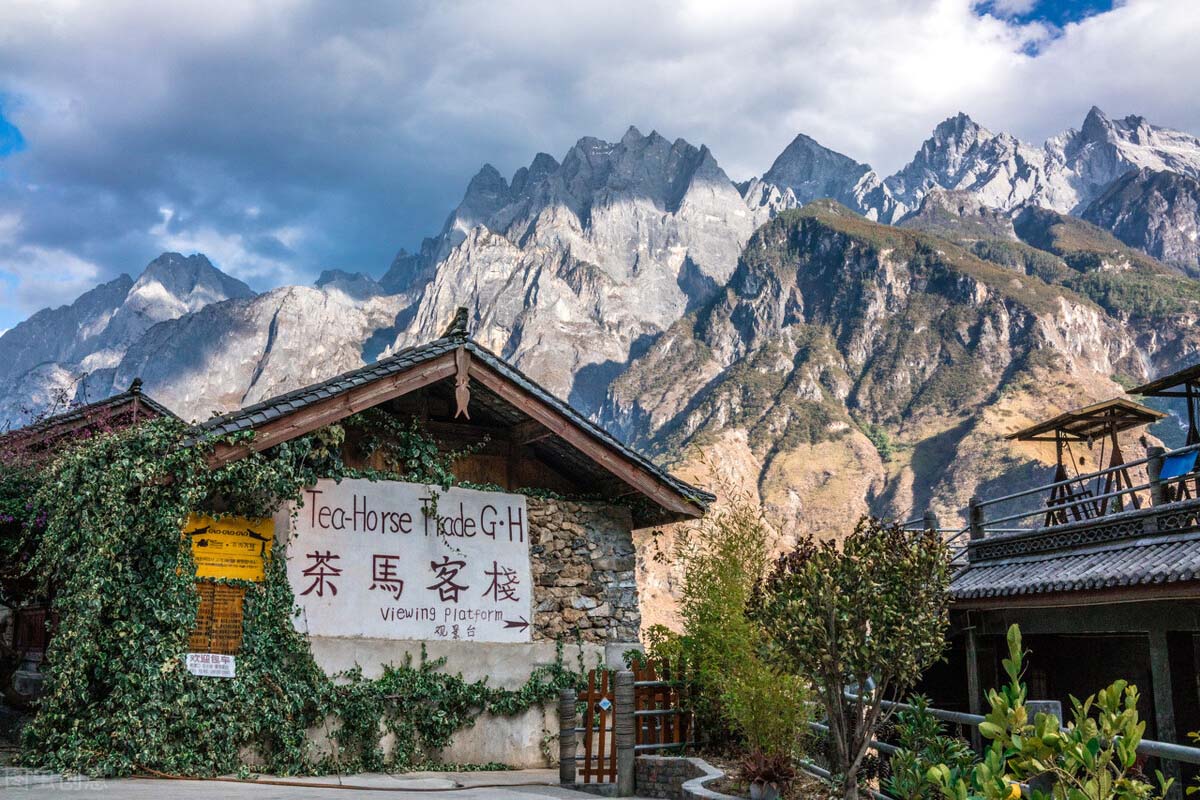
Jade Dragon and Haba face each other across the Jinsha. From the high trail the glacier on one side and the broad snow slope on the other sit in the same view — one of the deepest gorges on earth.
 Start your enquiry
Destinations / Tiger Leaping Gorge
Two snow walls, a river nearly 3,800 m below them, and a cliff path with a bed every few hours. It also sits exactly where a longer Yunnan journey needs it.
Explore the guide ↓North-west Yunnan · Jinsha River
Tiger Leaping Gorge is where the Jinsha River — the upper Yangtze — cuts between two snow massifs: Jade Dragon at 5,596 m on the south bank and Haba at 5,396 m on the north. The river sits near 1,800 m, so the walls rise almost 3,800 m above it. At the narrowest point the water is squeezed into a gap only metres wide, which is where the name comes from.
What makes it unusual as a destination is how little stands between a visitor and that scale. There is no permit, no expedition and no tent required: a contour path built by farmers runs along the north wall, with guesthouses and hot meals every few hours. Two days is enough to cross it; the route brief sets out the walking.
But the gorge is rarely the whole trip. Qiaotou, at the southern gate, is on the Lijiang–Shangri-La road about two hours from either town; Haba village, the base for a 5,396 m snow summit, is on the far bank; and the old Tea-Horse Road passed through here on its way north. It works as the hinge of a north-west Yunnan journey rather than a standalone stop.
What the gorge is, and what you can see from it.
Jade Dragon and Haba face each other across the Jinsha. From the high trail the glacier on one side and the broad snow slope on the other sit in the same view — one of the deepest gorges on earth.
At Upper Gorge the river funnels through a gap only metres wide around a midstream boulder. The road-side viewpoint is the quickest way to understand the scale before committing to a walk.
A farmer-built contour trail roughly 500 m above the road, past the 28 Bends and a line of guesthouse terraces facing the glacier. Two days from Qiaotou to Tina’s; the night is usually at Halfway, around 2,400 m.
Steep villager-built paths drop to the river where the water turns over the rapids. They are charged separately from the scenic-area ticket, and are a different half-day from the high trail.
The timber village on the north bank is the base for Haba Snow Mountain. Seeing it from the trail is often what turns a gorge walk into a longer plan.
The gorge walks well in the dry months; the mountain has its own windows.
Clear views, cold nights on the ledge and the settled window for the high trail. The October holidays are the busiest weeks; late autumn and spring are the quieter overlap with Haba.
Rain season. July and August bring rockfall and occasional trail closures, and the river runs high. We confirm the path’s status before fixing any dates.
The two settled summit windows on Haba. Both sit inside the good gorge-walking months, which is why the two can be combined in one trip.
How the gorge links to Lijiang, Haba and the plateau — and where the walking detail lives.
Most journeys start here: Dayan old town, the Naxi water system and Jade Dragon at the head of the gorge. It deserves its own nights rather than a same-day transfer — see the Lijiang guide and the Dali & Lijiang guide.
The 5,396 m snow mountain rises opposite Jade Dragon, and the five-day expedition starts and ends in Lijiang along the same corridor. The high trail and the climb share one road, so they can be joined with a transfer around the north bank — two modules, not a single published itinerary.
The road climbs out of the gorge onto the plateau. The eight-day overland journey includes a day on the high trail before continuing to Shangri-La and the Meili range; the north-west Yunnan region guide sets out the wider combinations.
The route brief covers tickets, buses and the choice between a two-day and three-day walk. The day-by-day page takes the high trail stage by stage.
Make room for local life, food and cultural encounters.
Pressed tea and mules moved through this corridor for centuries on their way to Tibet. The caravan towns, way stations and gradients that set the trade are covered in the Tea-Horse Road note.
Lijiang and the villages along the southern approach are Naxi. The pictographic Dongba script is still in use there — see Dongba notes.
Useful details to discuss when shaping your trip.
The scenic-area ticket is ¥45 on the Shangri-La side; the Middle Gorge descents are charged separately. No permit or compulsory guide is needed for the high trail. Full details are in the route brief.
Qiaotou is about two hours by bus from Lijiang or Shangri-La. Guesthouses can send a main bag on to Tina’s, so the two days are walked with a daypack.
Tell us your dates, whether you want two days on the high trail or a week that also reaches Haba village, and how much time you would like in Lijiang. We will come back with a written outline — and check the trail’s status before any dates are fixed.
Start my journey brief ↗