The Hui–Hang road
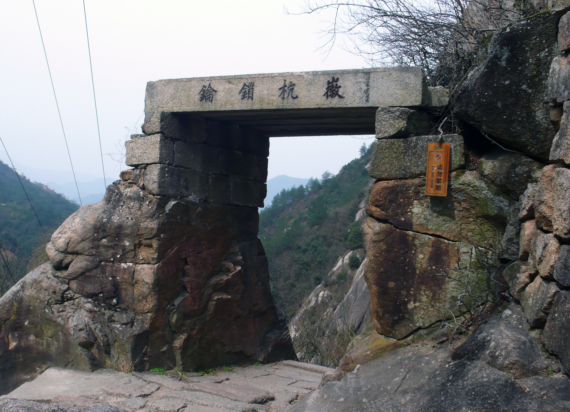
From Jixi over the ridge into Zhejiang, past the Jiangnan First Pass — some 1,400 stone steps rising to about 424 m — then the long climb to Lantian’ao at 1,050 m. The busiest of the five, and the only one with an entrance fee.
 Start your enquiry
Destinations / Anhui / The stone roads
One prefecture left a network of paved roads that connect villages rather than summits. They are still walkable, mostly unmanaged, and slick as glass in the rain.
Explore the guide ↓Southern Anhui · the Huizhou trail network
When Huizhou stopped being an administrative region in 1987, it left behind an unusually literal inheritance. A survey by Huangshan municipality catalogued 77 historic trails inside its boundaries, together with some 730 kilometres of paved road. At provincial level the count is larger: Anhui’s cultural trail programme lists 196 surviving routes totalling more than 1,500 kilometres, and has been running guided walks along a shortlist of six since 2025.
The pattern is what makes the network unusual. Almost every one of these roads connects villages rather than summits, and the villages are still inhabited. A day on them ends at a bed and a kitchen rather than a tent, and the walking is mostly under 20 kilometres with modest altitude. The difficulty is the stone itself: uneven, polished by centuries of feet, and treacherous when wet.
That makes this the least technical mountain walking on this site and the most dependent on timing. It is not expedition terrain. It is a way of moving through a working landscape, where the point of the day is the village you arrive in rather than the view from a high point.
One with a gate, one with a car park, and three with neither.
From Jixi over the ridge into Zhejiang, past the Jiangnan First Pass — some 1,400 stone steps rising to about 424 m — then the long climb to Lantian’ao at 1,050 m. The busiest of the five, and the only one with an entrance fee.
The merchants’ road to Raozhou, starting at a Qing arch bridge in Zhangqian and climbing eighteen switchbacks to a Wu–Chu boundary stone on the watershed between the Yangtze and the Qiantang.
Laid out in the late Ming for the route toward Kaihua in Zhejiang. Old tea trees, southern hemlock, and terraces measured in strips rather than areas. Fewer people walk it than either of the others.
The road from Huizhou to Anqing, inscribed at the top as the highway to the provincial capital. About 533 m of climb, paving more than three metres wide, and twelve Qing stelae at the ruined pavilion.
Dry stone is a different surface from wet stone.
The best window. Dry underfoot on most days, green in the valleys, and the tea terraces being picked in April. Rain is frequent but usually short.
The wet season, and the season to avoid: the paving turns slick, the vegetation closes in, and the heat in the valleys is oppressive. If you come, come for the villages instead.
Dry, clear and cool, with the best light. October is the pick. The roads are at their most pleasant and the villages at their busiest, which is a fair trade.
Cold, quiet and occasionally snowy. The stone is fine when frozen and dangerous when thawing. Few walkers, and the villages at their most themselves.
Villages at both ends, and a car in the middle.
Every one of these roads starts in a village and ends in a village, which is the whole design. Arrange a pick-up at the far end, or walk back; there is rarely a bus.
Jixi to the pass and back is a full day of about 15 km with 600 m of gain. The through-walk into Zhejiang needs a car at the far side and a night in a village.
No ticket, no visitor centre, no signage in places, and nobody coming if something goes wrong. All three are between 7.5 and 12 km and end in a village, which keeps the risk contained.
What the paving tells you if you look at it.
Roads built for carrying loads are wide, with shallow steps and drainage cuts on the uphill side. The Dahongling paving is over three metres across, which tells you what kind of traffic it was built for.
Blocks of different size and different stone mark repairs in a later century. On a road with no other interpretation on offer, that is the most readable history in the landscape.
Boundary stones, route inscriptions and Qing stelae survive at the passes. The Wu–Chu stone marks a line drawn in the Spring and Autumn period, roughly two and a half thousand years before anyone walked this paving.
Footwear, water and the state of the vegetation.
The stone is polished and, when wet, genuinely slippery. Sticky rubber matters more than ankle support here; poles are useful on the descents.
Villages have shops and kitchens; the passes have nothing. Carry a litre and a lunch for any of the through-walks.
The main road is obvious. The unmanaged ones are obvious in the middle and vague at both ends, where new tracks and orchards cross the old line. Take a downloaded map, and ask in the village before you set off.
Tell us how far you want to walk in a day and whether you need a bed at both ends. We will pick the road that fits, and the villages that go with it.
Start my journey brief ↗