Hailuogou & the No.1 glacier
A shuttle to the trailhead, then boardwalks to the viewing platform above the ice fall, which drops 1,080 metres over a width of about 1,100. The glacier tongue runs six kilometres into old-growth forest.
 Start your enquiry
Destinations / Sichuan / Gongga
The highest mountain in China outside the Himalaya, and a glacier that ends in forest at 2,850 metres. One side is a tourist valley with hot springs; the other is a five-day walk around the massif.
Explore the guide ↓Daxue range · 7,556 m
Gongga, at 7,556 metres, is the highest point in China outside the Himalaya and the reason the Chinese call it Shu Shan Zhi Wang — the king of the Shu mountains. It sits in the Daxue range west of Kangding, and the drop from the summit to the Dadu river is close to 6,000 metres over a horizontal distance of about thirty kilometres. That is one of the greatest relief figures on earth, and it is why the mountain carries glaciers at a latitude where nothing else does.
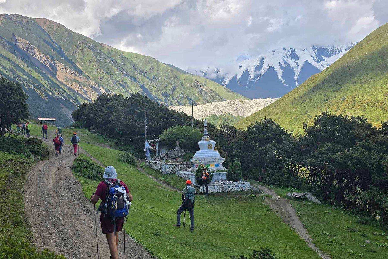
There are two ways to meet it. Hailuogou, on the east flank, is a developed scenic valley with a shuttle, boardwalks, a viewing platform and hot springs, where the No.1 glacier’s tongue reaches down to 2,850 metres and ends among the conifers. The west flank is the trekking side: the valley above Zimei and the old monastery of Gongga Gompa, where the mountain is seen across a bowl of moraine rather than from a bus.
The two are not interchangeable. Hailuogou is a half-day and works for anyone; the west-side walk is four to five days at 3,700–4,600 metres and needs fitness and acclimatisation. Both give you the same mountain from opposite sides, and the weather decides whether you see it at all.
A glacier valley, a monastery, and the walk between them.
A shuttle to the trailhead, then boardwalks to the viewing platform above the ice fall, which drops 1,080 metres over a width of about 1,100. The glacier tongue runs six kilometres into old-growth forest.
Springs at the foot of the glacier, several of them developed into pools. Soaking at 2,600 metres with ice above you is the reason many people remember Hailuogou rather than the mountain.
The old monastery on the western approach, at the foot of the moraine, with the mountain above it. Reached on foot over two or three days from the road at Zimei.
The walk around the massif on the western side, camping between 3,700 and 4,600 metres. Non-technical, high, and entirely weather-dependent.
A wet mountain that shows itself in autumn.
Spring, with snow still low and the rhododendrons out. Clear mornings are less frequent than in autumn but the valley is empty.
The monsoon, and the worst season here: the mountain is in cloud for weeks and the trails are wet. Hailuogou remains visitable but the summit rarely appears.
The best window by a wide margin. October and early November give the highest probability of a clear summit, and the forest turns. Cold nights.
Winter: clear and very cold, with ice on the boardwalks and some upper sections closed. The mountain is at its sharpest and almost nobody is there.
Six hours from Chengdu to the east gate.
About 319 km from Chengdu to Hailuogou via Ya’an and the Dadu valley, six hours by road. The west side is reached via Kangding and Zimei, a further three to four hours.
Hailuogou runs its own shuttle from the gate to the upper stations; the boardwalks and the glacier platform are then on foot. The west-side route needs a vehicle and a guide throughout.
Moxi town at the gate of Hailuogou for the developed side, with hot-spring hotels; camping or guesthouses on the western circuit. Two nights at Moxi covers the glacier and the springs.
Why this one reaches so low.
A summit at 7,556 metres and a river at around 1,100 within thirty horizontal kilometres gives the mountain an unusual amount of mass to move. The glaciers are steep, fast and heavily crevassed, and they descend further than latitude alone would allow.
The tongue ends at 2,850 metres, inside the conifer belt, which produces the image the valley is known for: ice above, forest below, no bare zone in between. It is one of the lowest glacier termini in Asia.
Gongga is a Tibetan name, and the mountain is sacred to the communities on its western side. The monastery and the kora routes around it predate the scenic area by centuries, and the two do not always sit easily together.
Altitude and cloud, in that order.
The western approach climbs fast. A night at Kangding at 2,560 m before moving to 3,700 makes the difference between a good walk and a headache.
Gongga is in cloud more often than it is clear, even in the dry season. Build two nights on the west side if the summit view is the point, and accept that it may not happen.
The Hailuogou glacier is crevassed and rapidly changing; the walks stop at the platform and the moraine. Do not step onto the ice without a guide and a rope.
Tell us whether you want the glacier from a boardwalk or the mountain from a moraine. The first is a day; the second is a week and a gamble on cloud.
Start my journey brief ↗