Zheduo Pass
The first real pass west of the basin, with prayer flags, a car park and a view back over the gorge you have just climbed out of. Cold, windy and worth ten minutes.
 Start your enquiry
Destinations / Sichuan / Kangding
The old tea-and-horse town at the bottom of a gorge, and the high road west of it: a 4,298-metre pass, poplar valleys, grassland with a snow peak on the horizon, and the stone towers of Danba.
Explore the guide ↓Garzê prefecture · 2,560 m
Kangding is a town of about a hundred thousand people wedged into a gorge where two rivers meet, at 2,560 metres, and it has been the gateway to the Tibetan plateau for centuries. The old tea road ran from Ya’an over the Erlang pass to Kangding, where the bricks were repacked and carried west by mule and yak; the trade in tea for horses was the reason the town existed.
The town itself is small and steep, with a river running through the middle and the houses stacked up both walls of the valley. What matters for a traveller is what lies on either side. East is the last of the forested gorge country; west, the road climbs over Zheduo Pass at 4,298 metres and the landscape opens into the wide, grazed valleys that everyone means when they say western Sichuan.
West of the pass, three places do most of the work. Xinduqiao, an hour down, is a valley of poplars and braided water that photographers have been circling since the 1990s. Tagong, further on, is open grassland with a monastery and the snow cone of Yala on the horizon. And south of Kangding, the road drops to Danba, where the stone towers and the Tibetan houses sit in a much warmer, drier valley.
One pass, three valleys and a bridge with a history.
The first real pass west of the basin, with prayer flags, a car park and a view back over the gorge you have just climbed out of. Cold, windy and worth ten minutes.
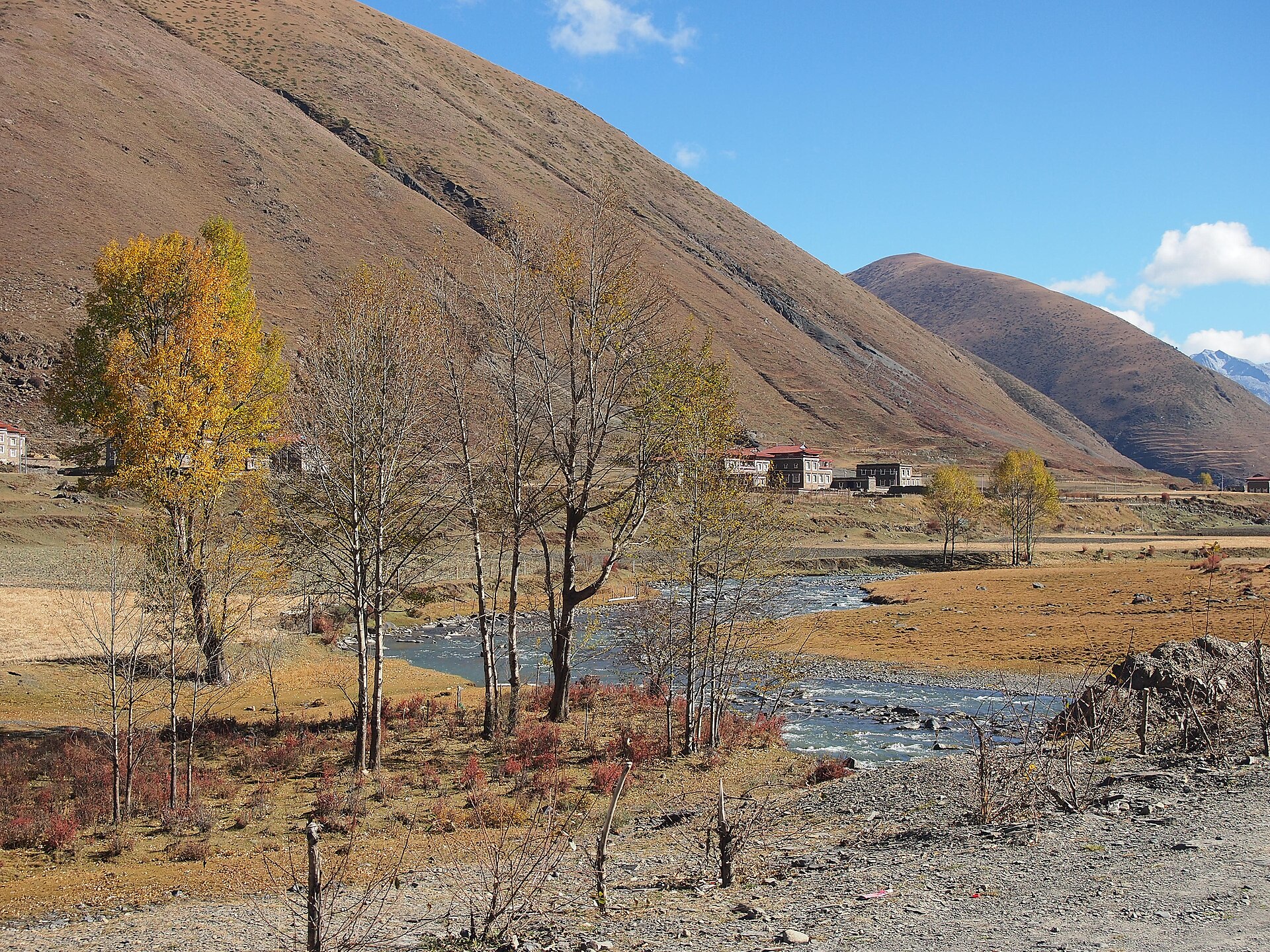
A wide valley floor of braided streams and poplars, with Tibetan houses on the banks. The light is best in the two hours after dawn and the two before dusk.
Open grazing country with a monastery and a small town, and the pyramid of Yala mountain to the north. Horse riding, nomad tents in summer, and a lot of wind.
South of Kangding in a dry, warm valley: stone watchtowers, and villages of tall, flat-roofed houses stacked on the slope at Jiaju. A different climate and a different architecture from the plateau.
Two clear windows, and a pass that closes.
Spring, with snow still on the high ground and the valleys greening. Clear mornings are less reliable than in autumn but the roads are empty.
The monsoon: green, wet, and prone to landslides on the G318. The grassland is at its best and the peaks are usually hidden.
The best window. Clear, cold mornings, the poplars turning in late October, and the highest chance of seeing Yala and Gongga from the passes.
Winter. Zheduo Pass can close in snow, the grassland is brown and the light is hard. Beautiful and very cold; check the road status before committing.
Six hours from Chengdu, and everything goes over one pass.
About 280 km from Chengdu on the G318, six to seven hours by road, or a 55-minute flight to Kangding airport at 4,280 m — high enough that flying in is a poor idea on day one.
The G318 is the spine: Kangding, Zheduo Pass, Xinduqiao, Tagong, and on to Litang. Danba is a separate road south. Shared vans run the main road; the side valleys need a vehicle.
Kangding for the town and the acclimatisation, Xinduqiao for the valley light, Tagong for the grassland. Two nights at 3,300 m before going higher is the sensible sequence.
A trade route that became a road trip.
Brick tea from Ya’an was carried by porters over the Erlang pass to Kangding, then repacked into leather bundles and loaded onto mules and yaks for Lhasa. The whole trade was a response to the Tibetan diet, which needed tea to process meat and butter.
The road west from Chengdu to Lhasa is now the most famous drive in China, and Kangding is where it stops being a highway and starts being a mountain road. In summer it carries a continuous line of cyclists, motorcycles and SUVs.
Kangding is inseparable, in Chinese popular culture, from a love song written in the 1940s and sung ever since. Every taxi driver will tell you about it, and it is genuinely the reason many domestic visitors come.
Altitude, weather and the state of the road.
The pass is at 4,298 m and Tagong at 3,700. A night at 2,560 before crossing is what separates a good week from a headache and a wasted day.
The G318 through the gorge closes for a few hours at a time after heavy rain, most years between June and August. Build a spare half-day into any route that depends on it.
Some counties further west require permits for foreign travellers. We arrange them with the rest of the route; independent travellers should check before booking anything beyond Litang.
Tell us how far west you want to go and how many nights you can spend above 3,000 metres. The road rewards people who stop, not people who drive.
Start my journey brief ↗