Huguan
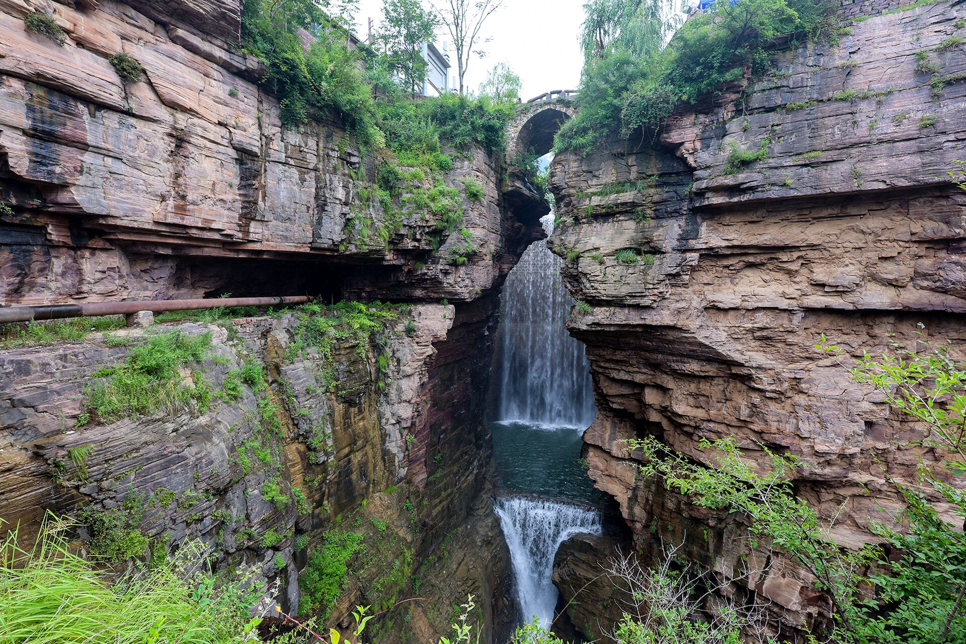
The deepest and most developed section, with a chain of narrow gorges — Eight Springs, Black Dragon Pool, Red Bean — joined by a road, boats and a lift. Busy, but the walls are 300 metres and the water is real.
 Start your enquiry
Destinations / Shanxi / The Taihang
The eastern wall of the province: a single escarpment that drops 1,500 metres to the north China plain, cut into gorges, and — at one village — tunnelled by hand for thirty years.
Explore the guide ↓Eastern Shanxi · the escarpment
The Taihang runs north to south along the whole eastern edge of Shanxi, from the Yan mountains above Beijing to the Yellow River near Jiyuan, and it is less a range than a step. On the west side the ground rises gradually through loess hills; on the east it falls away in cliffs of red sandstone and limestone almost to the plain. The height difference across the escarpment is around 1,500 metres, and in places it happens in a kilometre.
The rock is layered: bands of sandstone and shale, tilted slightly, then cut by rivers working down through the bedding. The result is a series of deep, narrow gorges with vertical walls a few hundred metres high — at Huguan, at Pingshun, at Lingchuan — and a set of villages on the plateau above them that had, for most of their history, no road in.
That last fact produced the thing the Taihang is now known for. Between 1962 and 1991 the villagers of Xiyagou, 830 people on a shelf below the cliffs, cut a road through the mountain by hand: 7.5 kilometres of tunnel and gallery, driven with hammers and crowbars, with windows knocked through the outer wall for light and spoil. Three generations did it. It is the most legible piece of infrastructure in China, because you can still see the tool marks.
Four places where the escarpment opens.
The deepest and most developed section, with a chain of narrow gorges — Eight Springs, Black Dragon Pool, Red Bean — joined by a road, boats and a lift. Busy, but the walls are 300 metres and the water is real.
A gorge system south of Huguan with fewer visitors, a river running the length of it, and cliffs that close to a few metres at the narrowest point. The walk in is the point.
The highest part of the south Taihang, with a plateau of pines and a view east over the plain. The ridge is where the escarpment is most clearly a single step.
The distinctive feature of the south Taihang: cliffs of red-brown sandstone, bedded in horizontal lines and stained dark by water, with green scrub on every ledge.
Seven and a half kilometres, thirty years, three generations.
The village sits in a basin below the cliffs, 800 metres below the plateau. The only way out was a two-day walk over the mountain. In 1962 the village started digging.
No machinery, no engineer for most of it, and a technique worked out as they went: follow the cliff, cut a gallery, knock windows through the outer wall to dump spoil and let in light, then spiral upward.
The openings in the outer wall of the tunnel are the reason the road is famous. They light it, ventilate it, and give a view straight down several hundred metres to the valley floor.
The road was completed in June 1991, after thirty years and several deaths. In 2009 it was listed as one of the sixty landmarks of the People’s Republic’s first sixty years.
Xiyagou itself is a cluster of stone houses and terraced fields on a shelf below the cliff, with a waterfall at the head of the valley. Small, quiet, and full of guesthouses now.
The tunnel is single-lane with passing places, and buses are not allowed. Drive it slowly, sound the horn at the blind corners, and stop only where the gallery widens.
May to October; the gorges carry water after the summer rain.
The best walking weather: 15 to 26 degrees, green, and the gorges running clear. Water levels are low but the light is good and the crowds are thin.
The rainy season, and the reason to come: the gorges fill, the waterfalls work, and the plateau goes deep green. Afternoon storms are violent and the cliff road can close.
The best all-round window. 12 to 24 degrees, dry air, autumn colour starting on the upper slopes in the last week of October, and the gorges still carrying water.
Cold and dry. The cliff road ices up and some gorge sections close. Snow on the red walls is spectacular and the villages are empty.
A car, two nights, and a north-to-south line.
The gorges sit between Changzhi and Jincheng. High-speed rail reaches Changzhi East and Jincheng East; from either, the gorge entrances are one to two hours by road.
Three days: Huguan gorges on day one, Pingshun on day two, Wangmangling and the Xiyagou road on day three. Or reverse it, driving south from Changzhi.
Guesthouses at Xiyagou and in the villages above the gorges. Changzhi and Jincheng have proper hotels if you prefer a base with a daily drive.
The cliff road is narrow, unpaved in places, and closed to large vehicles. A local driver who knows the passing places is worth more than a rental car.
What thirty years of hand labour actually means.
The village had no road, no clinic, and no way to sell anything heavier than a basket. Two earlier attempts at a surface road failed on the cliffs; the tunnel was the third plan and the one that worked.
Several villagers died during the work, and the tunnel consumed the labour of a generation. The road is now a monument to that, and the village is a resort because of it — which is a complicated outcome and worth holding in mind.
They learned to cut from the inside out: a gallery along the cliff, windows through the outer wall for light and spoil, then a spiral to gain height. It is the same principle as a mine adit, arrived at without a mining engineer.
Steep ground, narrow roads and real exposure.
Most gorge walks are on steel stairways bolted to the cliff, wet from spray and slippery. Railings are continuous; vertigo is the main issue, not safety.
The cliff road and the gorge approach roads are narrow with blind corners. Do not self-drive unless you are comfortable with Chinese mountain roads and single-lane tunnels.
Storms in July and August drop rock and close roads without much warning. Ask locally before committing to the cliff road in the afternoon.
Mobile signal is patchy in the gorges and the villages take cash for small things. Carry some, and download offline maps.
Two nights based at Changzhi or in the gorge villages: one day for the Huguan gorges, one for Pingshun and the Xiyagou road. Add a third for Wangmangling if the weather is clear, because the escarpment only makes sense from above.
Start my journey brief ↗