The bend
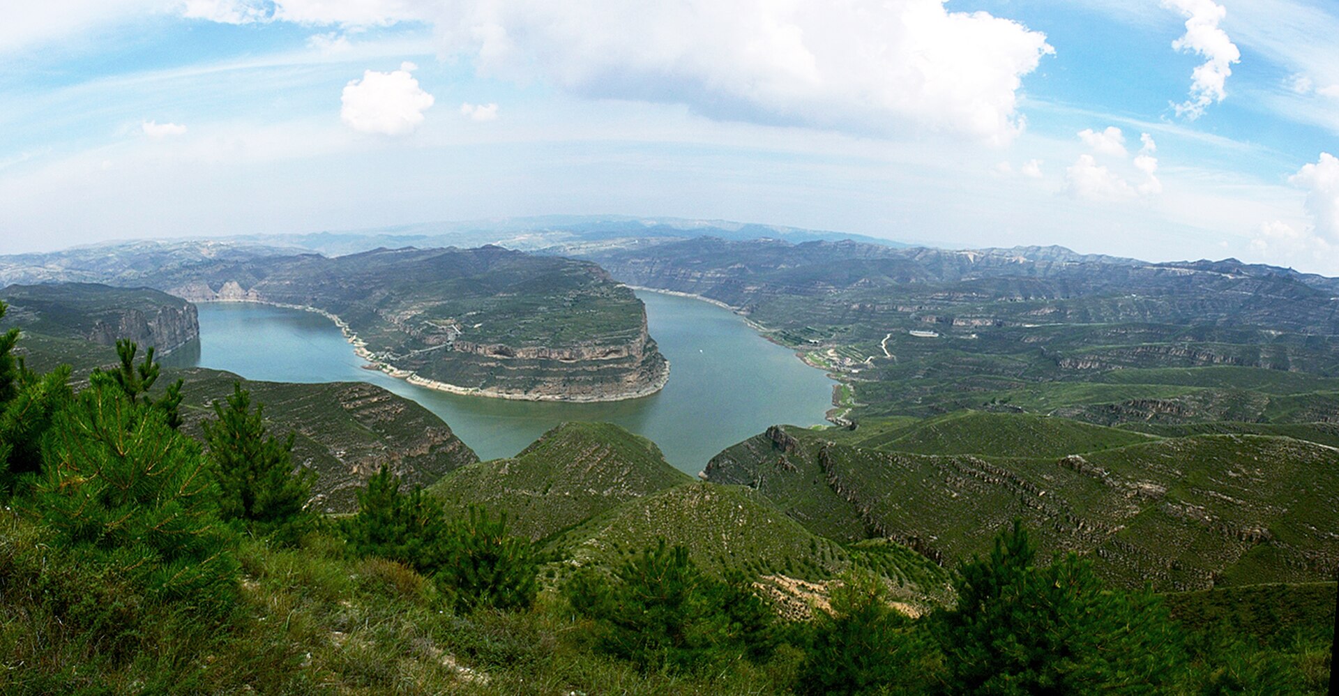
The river comes out of the gorge and swings through a near right angle around a sandstone bluff, with Inner Mongolia on the far bank. From the fort wall above, the whole turn is visible at once.
 Start your enquiry
Destinations / Shanxi / The Yellow River
Along the western border the river runs in a gorge 725 kilometres long, between Shanxi and Shaanxi. At Laoniuwan the Great Wall comes down to meet it; at Qikou a Ming trading port still stands above the water.
Explore the guide ↓Western Shanxi · the Shanxi–Shaanxi gorge
For 695 kilometres the Yellow River is the western and southern edge of Shanxi. It enters from Inner Mongolia at Hekou, runs south through a gorge that deepens to more than a hundred metres, and leaves the province at the Hukou falls and then at Longmen. The whole reach is a single continuous canyon cut into loess and sandstone, and it is the reason Shanxi has a definable west side at all.
The gorge has been a border, a road and a market. The border is the oldest: the Great Wall runs down to the river at Laoniuwan, and the Ming built fortresses along the bank. The road is the river itself — before railways, goods came up and down it by boat, and where the water was too shallow to navigate they were carried around. The market grew at those points, and the largest of them was Qikou.
The drive along the west of the province, on the road signed as the Yellow River route, runs about 600 kilometres between Laoniuwan in the north and the Hukou falls in the south. It is now the best road journey in Shanxi: the river on one side, loess terraces and abandoned villages on the other, and almost no traffic.
Where the wall meets the water.
The river comes out of the gorge and swings through a near right angle around a sandstone bluff, with Inner Mongolia on the far bank. From the fort wall above, the whole turn is visible at once.
A rammed-earth and stone fort on the bluff, built in 1467 as part of the inner wall system, with a brick watchtower on the cliff edge that still stands.
A stretch of wall runs from the fort down to the water, the point the Chinese call “the handshake”: the only place where the Great Wall meets the Yellow River.
Twenty kilometres down, a dam built in the 1990s has turned the gorge into a still lake, which changed the colour of the water and the life of the villages along it.
A port that lost its river traffic.
A single street of stone shops and courtyard houses climbing the slope above the water, with the old quay, warehouses and inns still legible. No cars inside the old street.
Qikou was where boats from the north could go no further and cargo was transferred to mules for the road into the Fen basin: grain, oil, wool, salt. It was a transfer point, and it made the town rich.
A walled village one kilometre north where the Chen family, the port’s biggest traders, built their houses: courtyards stepping up the slope, connected by roof walks and tunnels.
A village of cave dwellings stacked up a loess slope three kilometres south, promoted by the painter Wu Guanzhong in the 1980s and now a standard stop for art students. Steep, quiet, and best in the late afternoon.
April to June and September to October; the river is highest in August.
Dry, clear, 12 to 26 degrees, with the loess terraces green after the spring rain. The road is at its best and the villages are quiet.
The flood season. The river runs wide and brown, which is what most people want to see, but the road can be cut by landslides and the gorges are hot.
The best window: clear air, 10 to 24 degrees, dates and jujubes ripening on the terraces, and the river still carrying summer water.
Cold, dry, and very empty. Minus 10 to minus 18 in January. The river can carry ice, and some sections of the road are closed by snow.
Six hundred kilometres, four days, no traffic.
Laoniuwan is 50 kilometres from Pianguan and about four hours from Taiyuan. The last stretch is a single-track road along the ridge; the fort is a half-hour walk from the car park.
Qikou is three hours south of Laoniuwan on the river road, with Xiwang and Lijiashan within ten minutes of the town. Two nights here is the natural pause.
Hukou is a further four hours south, at the point where the whole river drops 30 metres into a slot 50 metres wide. The Shanxi side has the closer view; the Shaanxi side has the long one.
Around 600 kilometres from Laoniuwan to Hukou, four days at an easy pace with stops. Fuel and food are sparse; fill up at county towns and carry water.
What a transfer port actually did.
Above Qikou the river is shallow and fast over rock; below it deepens. Boats coming down from Inner Mongolia had to unload here, and cargo went on by mule. A natural break in transport made a town.
The Chen family of Xiwang were the largest, with warehouses, inns and moneylending. Their houses are the best surviving example in Shanxi of merchant architecture without official rank behind it.
The railways and the motor lorry, from the 1920s onward. Qikou lost its function almost completely, which is why the street is intact and why nobody rebuilt it.
Narrow roads, loose edges, and villages that are still lived in.
Single lane in places, with unguarded edges and blind bends. Do not drive it at night. A local driver is the sensible option for the northern section.
People live in the houses you are photographing. Ask before going into courtyards, and do not climb on the cave roofs.
Guesthouses in Qikou’s old street and in Lijiashan, mostly cave rooms. Simple, cheap, and cold in winter — ask about heating.
There are long stretches with neither. Carry two litres per person and fill the tank whenever it drops below half.
Four days from Laoniuwan to Hukou, with two nights at Qikou: the fort and the bend, the port street and Xiwang, then Lijiashan in the late afternoon. It is the best road in the province and one of the emptiest.
Start my journey brief ↗