The summit
A granite tooth with a small stone hall on the top, built on a platform of about six square metres. The last stretch is a scramble on rock; the view runs to the Wutai ridges on a clear day.
 Start your enquiry
Destinations / Shanxi / Luya Shan
The northern end of the Lüliang: spruce forest at 2,700 metres, a meadow above the treeline, a village built out over a cliff, and a cave that keeps its ice through the summer.
Explore the guide ↓North-west Shanxi · Ningwu · 2,736 m
Luya Shan is the highest part of the Guancen range, which is itself the northern end of the Lüliang, and it sits in the far north-west of the province where the loess gives way to older rock. The contrast is what makes it: the surrounding hills are dry, terraced and yellow for most of the year, and the mountain above 2,000 metres is dark with spruce and larch, with a subalpine meadow at the top.
The main summit is 2,736 metres, a rocky tooth that gives the mountain its name — luya, a bamboo shoot. The highest point of the range is a neighbouring ridge at 2,787 metres. Between them are 82,000 mu of primary and secondary forest and 66,000 mu of grassland, which is a large amount for Shanxi and the reason the area was made a national nature reserve in 1997.
Three things sit inside that landscape: the ice cave, the cliff village, and the spring that starts the Fen. They are within an hour of each other and they are the reason to come, though not in the same season — the cave is a summer attraction and the meadow is at its best in July.
Forest, meadow, and the villages between.
A granite tooth with a small stone hall on the top, built on a platform of about six square metres. The last stretch is a scramble on rock; the view runs to the Wutai ridges on a clear day.
One of the largest subalpine meadows in north China, at around 2,400 metres: grass, gentians in July, and larch scrub at the edges. Grazing stopped in the reserve, so it has come back fast.
Old-growth spruce on the north faces, larch and birch higher up, and a ground layer of ferns and moss that is unusual this far west. Brown eared pheasant, the province’s bird, lives here.
A village of stone houses on a ledge, the front half of each house carried on poles out over the drop. Reachable on foot in twenty minutes; still inhabited, though mostly by older people.
Ice in July, in a mountain that reaches 35 degrees in summer.
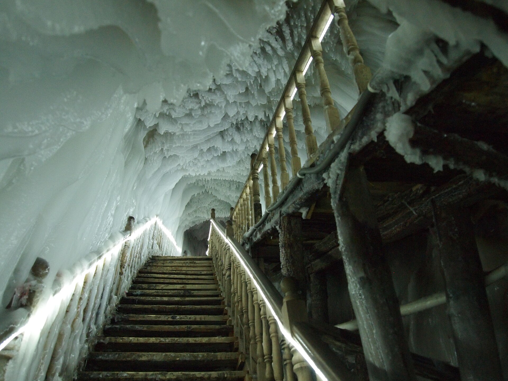
A vertical shaft in the limestone, about 100 metres deep in connected chambers, with ice columns, frozen falls and a floor of clear ice that lasts all year. The temperature inside stays below zero.
Cold air sinks into the shaft in winter and the shape of the cave traps it; in summer the cold air stays at the bottom, so the cave is a natural refrigerator. The ice is not glacial but annual, accumulated and preserved.
A timber stair and walkway run down through the chambers, with lighting. Twenty minutes underground, cold enough for a jacket even in August, and slippery throughout.
The cave sits in a limestone belt inside a granite massif — an unusual arrangement that is part of why the area is a national geological park as well as a nature reserve.
June to September for the meadow, and the cave any time of year.
The best season: the meadow flowers in July, daytime temperatures of 18 to 24 at altitude, and the cave at its most comfortable relative to the surface. Afternoon storms are frequent.
Clear, cool, 10 to 20 degrees, with the larch starting to turn in the last week. The best month for walking and the quietest of the summer months.
Colour peaks in the first half, then the first snow. The access road to the summit closes after heavy snow, and the cave stays open.
Winter: minus 15 to minus 25, snow on the ridge, and most of the upper roads closed. The cave is at its most spectacular and almost nobody visits.
One base at Dongzhai, two days for the mountain.
Ningwu is on the road between Taiyuan and Datong, about two and a half hours from either. Dongzhai, at the foot of the mountain, has the hotels and the ticket office.
The east line covers the ice cave, the cliff village and the cliff walkways; the west line covers the summit, the meadow and the Fen spring. They are separate days.
Day one: ice cave, cliff village and the walkways. Day two: summit and meadow, starting early. Three days if you want the Fen spring and the lakes.
The reserve is large and the roads inside it are slow. Allow 40 minutes between the cave and the summit trailhead, more in rain.
A river that starts here and waters a quarter of the province.
The Fen rises at the foot of the mountain near Dongzhai, from springs in a walled pool, and runs 713 kilometres south to the Yellow River at Hejin. Its basin holds a quarter of the province’s land and most of its people.
The pool is called the Fen source and has been treated as a sacred site since at least the Northern Wei; there is a small temple and a stele record of imperial visits.
Made a provincial reserve in 1980 and national in 1997. Grazing and logging inside the boundary stopped, which is why the forest and the meadow look the way they do now.
Cold ground, steep stairs and a long way from a hospital.
Below zero at any time of year, with water dripping. A jacket and shoes with grip are necessary; the boardwalk is wet throughout.
The last 100 metres to Taizi Dian is on rock with fixed chains. It is not technical but it is exposed, and it is not for anyone uneasy with heights.
The base is at 1,600 metres and the ridge at 2,787. Storms build in the afternoon; be off the summit by 2pm in July and August.
Dongzhai has hotels, food and fuel; inside the reserve there is very little. Carry water, and do not rely on mobile signal above the treeline.
Two nights at Dongzhai: the ice cave and the cliff village on the first day, the summit and the meadow on the second. Add a third for the Fen spring and the lakes, and go in July for the flowers.
Start my journey brief ↗