The kora
Darchen to Dirapuk, over the Dolma La to Zutulpuk, and out. Day two is twenty-two kilometres and a 5,630-metre pass; everything is built around it.
 Start your enquiry
Destinations / Tibet / Ngari
The far west: a lake at 4,590 metres, a mountain nobody climbs, a 52-kilometre kora over a 5,630-metre pass, and the ruins of a kingdom that traded with Kashmir.
Explore the guide ↓Western Tibet · Ngari prefecture
Ngari is the western third of Tibet, a high desert of gravel plains and salt lakes at 4,500 metres, bounded by the Karakoram, the Himalaya and the Gangdise ranges. It is one of the least populated places on earth. The road from Lhasa runs about 1,500 kilometres and takes three to four days, and the land between the towns is genuinely empty for hours at a time.
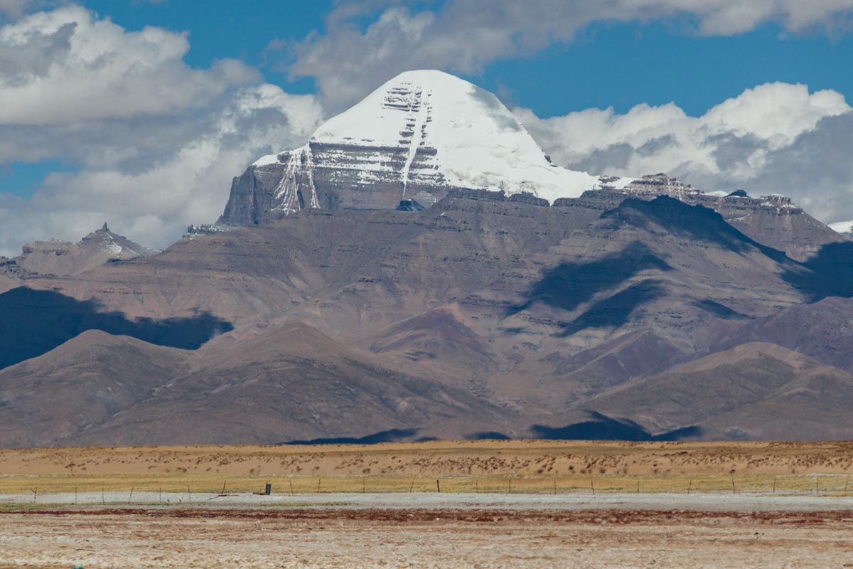
At the centre of it are two places that draw pilgrims from across Asia. Lake Manasarovar, at 4,590 metres, is a freshwater lake roughly 320 square kilometres in area, sacred to four religions and circled by a road and a pilgrim path. Beside it stands Kailash: 6,638 metres, a symmetrical peak of black rock with a snow cap, which nobody climbs because four faiths regard the summit as the throne of a deity.
The response is the kora: a 52-kilometre circuit, walked clockwise, over the Dolma La at 5,630 metres, in three days. Buddhists and Hindus walk it clockwise, Bön practitioners anticlockwise, and some pilgrims perform it with full-body prostrations, which takes weeks. It is the single most demanding standard itinerary we run in Tibet, and the most rewarding.
The lake, the mountain, the kora and the ruins.
Darchen to Dirapuk, over the Dolma La to Zutulpuk, and out. Day two is twenty-two kilometres and a 5,630-metre pass; everything is built around it.
A freshwater lake with the Gangdise range behind it, a pilgrim path along the shore, and the Chiu monastery on a rock above the water.
The pole that is replaced each year at the Saga Dawa festival, at the start of the kora. Prayer flags, pilgrims and a valley full of vehicles in festival week.
The ruins of a tenth-century kingdom in the Sutlej valley: a palace cut into a sandstone escarpment, and monasteries that once hosted Indian scholars.
A short season, and one festival.
The kora opens, the passes clear and the Saga Dawa festival falls in the fourth lunar month. Cold nights, clear skies.
Warmer, with cloud and rain on the Gangdise and occasional snow on the Dolma La. The busiest weeks for Indian pilgrimage groups.
The best conditions of the year for the kora: stable, dry and cold, with the mountain clear most mornings.
Effectively closed. Snow, closed passes, no services, and permits restricted. We do not run Ngari in winter.
Four days in, three days round, four days out.
Lhasa to Darchen is about 1,500 km and three to four days, via Shigatse, Saga and Zhongba. There is an airport at Ngari Gunsa, but flying in at 4,274 metres without acclimatisation is a bad trade.
Ngari sits in China’s border country, so beyond the Tibet Travel Permit it needs the Alien’s Travel Permit and a military permit, applied for in Lhasa with passport and itinerary details fixed in advance. Approval is not guaranteed and can take up to 30 days.
Guesthouse dormitories at Dirapuk and Zutulpuk, basic food, no medical facility and no reliable signal. Yaks or ponies can be arranged in Darchen; they carry bags, not people, on the pass.
One mountain, four claims.
Kailash is the axis of the world in Buddhist, Hindu, Jain and Bön cosmology. Climbing it has never been permitted, and the kora is the act of devotion instead.
Indian pilgrims arrive in organised groups in summer; Tibetan pilgrims arrive all season and often walk the kora in a single day. Both are on the path, not watching it.
The Guge kingdom ruled western Tibet from the tenth century until its collapse in the seventeenth, and its monasteries were centres of translation and painting. The site is fragile and partly closed.
Five and a half thousand metres, on foot.
The kora is not technical, but day two crosses 5,630 metres with a long descent. Anyone who has not slept above 4,000 metres before should build the approach slowly.
Below freezing before dawn on the pass in any month, and the wind is relentless. Down layer, shell, gloves, hat, and a sleeping bag rated for the guesthouses.
There is no hospital, no evacuation helicopter and no phone signal for much of the circuit. The group carries what it needs, and we say so before anyone books.
Tell us whether you want the kora or the lake, and how many days you can give the drive. Ngari is not a place to hurry.
Start my journey brief ↗