
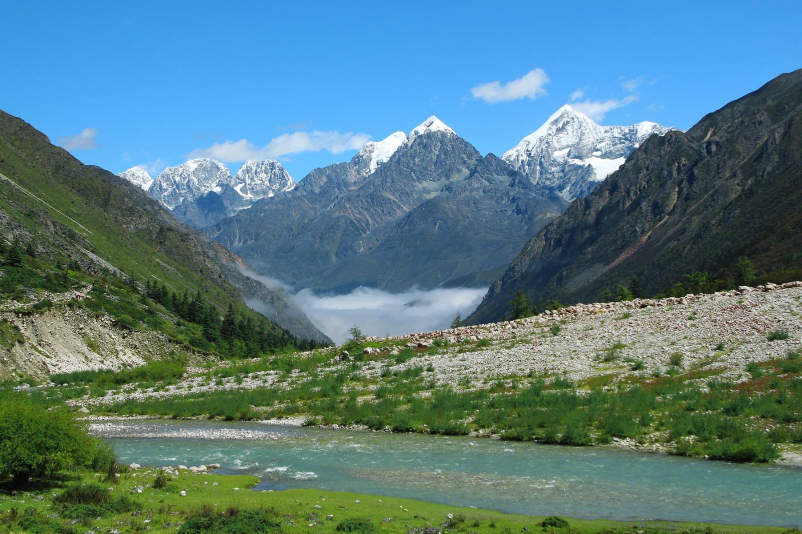
Snow peaks of the Minya Konka range rising above a green alpine valley with a turquoise river and mist on the valley floor

Trekking / Western Sichuan hiking tour

Private hiking tour

The Western Sichuan hiking tour.

Nine days across the full width of western Sichuan — four snow-mountain areas, two Tibetan farming-and-nomad counties and one glacier — walked in a line west from Chengdu and out again.

  • Duration9 days
  • Nights8
  • WalkingMost days, 4–20 km
  • Starts & endsChengdu
Ask about this itinerary

The Minya Konka range above the valley fog · the trip's longest horizon

Snow areas4

Siguniang, Yala, Minya Konka, Lamoshe

Best windowApr – Nov

runs all year; winter days are cold and some trails swap

Sleeping range1,600–3,800 m

the glacier night is the lowest, the grassland nights the highest

Day shapeWalk + drive

every walking day sits on a transfer, 1.5–5 hours

Why this route

The whole range, in one line.

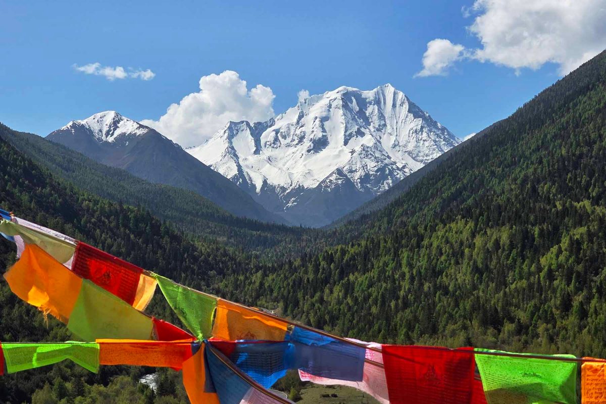
The snow-capped Mt. Yala massif rising above forested green slopes under a bright sky
Mt. Yala's north face, from the park below the holy mountain

Most Sichuan trips pick one mountain area and stay. This one walks a transect across the range country: the valleys of Mt. Siguniang, the farm villages of Danba, the nomad grassland at Tagong, the high trails under Minya Konka, and the Hailuogou glacier at the foot of Gongga Shan itself — 7,556 metres, the highest peak east of the Himalaya.

It goes to the parks, and then past them. The Tagong ridgeline and the Minya Konka west trail are horse routes above 4,000 metres where the day's company is herders rather than tour buses — the part of the range most visitors never reach.

It is a private departure, so the dates are yours and the shape can move: days, sights and the standard of the nights are all adjustable. April to November is the walking window; winter runs with some days exchanged.

The route

The line.

West out of Chengdu along the feet of the mountains, then south through the grassland and down the glacier, and home. Five overnight bases.

  1. Days 01–03Siguniang → Danbatwo valley walks, one village walk
  2. Days 04–06Tagong → Xinduqiaothe holy lake, the grassland ridge, the Konka west trail
  3. Days 07–09Kangding → HailuogouMugetso lake country, the glacier, the road home

Day by day

The nine days.

Each day lists where you sleep, how much road there is, and what the walking asks. Distances flex with the season and with you.

  1. Day 01

    Balang Pass and the first valley

    Chengdu → Mt. Siguniang

    An eight o'clock start and four hours of road into the mountains, over the Balang Pass tunnel near 3,800 metres, to Rilong at the foot of Mt. Siguniang. The afternoon belongs to Shuangqiao Valley: a park bus to the head of the 35-kilometre valley, then the boardwalk back down along the river under peaks with names like Mt. Abi and Mt. Potala.

    Walk as much of the first 8 kilometres as you like — it is the best of the valley and almost flat. The pace is deliberately easy: the night is spent at 3,100 metres, and the acclimatisation matters more than the distance.

    • OvernightRilong, 3,100 m
    • Drive4 hours
    • On foot5–12 km, easy
  2. Day 02

    Changping Valley, under the big faces

    Mt. Siguniang

    A full day in Changping Valley, the one valley at Siguniang with no road past the entrance. A bus to the lamasery, then trail: through the dead-tree flats of Kushutan, along the boardwalk to its end at Lower Ganhaizi, and on up to the open meadow of Muluozi directly under the mountain's north faces.

    Horses are available for the first stretch if you would rather ride. Turn around at any point — the walk out is the same trail, and every step of it faces the mountain.

    • OvernightRilong, 3,100 m
    • On foot14–20 km, or less
    • TerrainTrail and boardwalk
  3. Day 03

    A village day at Zhonglu

    Siguniang → Danba

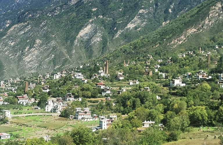
    The hillside Tibetan village of Zhonglu in Danba, stone houses and orchards on a sunny slope
    Zhonglu · the most unspoiled of the Danba villages

    Three hours of road to Danba, one of the most distinctive Tibetan farming districts in the province, and the day's walk is a gentle one: the hillside village of Zhonglu, its stone houses and orchards stacked up a sunny slope below ruined watchtowers.

    Four to eight kilometres of paths between the hamlets take in the best viewpoints including the No. 3 photo spot. The night is low, at 2,200 metres — a good breather after two nights at altitude.

    • OvernightDanba, 2,200 m
    • Drive3 hours
    • On foot4–8 km, easy
  4. Day 04

    The holy lake under Mt. Yala

    Danba → Tagong

    An hour and a half of road to the Mt. Yala park, a small bus to the trailhead at 3,750 metres, then the steep 3-kilometre climb — on foot or on horseback — to the lake called Yala Yumtso at 4,050 metres, directly under the glaciers of the holy mountain's north face.

    If legs and weather allow, a pass beyond the lake leads to two more lakes at 4,200 metres and the best open views of the day. Afterwards the road runs another hour to Tagong, visiting the Huiyuan Temple en route when time allows.

    • OvernightTagong, 3,800 m
    • Drive2.5 hours
    • On foot6–14 km, challenging
  5. Day 05

    The grassland ridgeline

    Tagong

    The morning starts at Tagong Monastery, the Sakya school's most respected seat in Kham, before the walk: a steep pull out of the valley, then a long series of rises and dips along a ridge above the grassland, with the Minya Konka, Lamoshe and Yala ranges all in view at once.

    Around 15 kilometres and most of the day. The descent drops to a Buddhist academy at the far end where the vehicle waits. A gentler variant runs the ridge the other way, starting high and walking down.

    • OvernightTagong, 3,800 m
    • On footAbout 15 km, 7–8 hours
    • TerrainGrassland ridge
  6. Day 06

    The west trail above 4,000 metres

    Xinduqiao · Minya Konka west

    Out of Xinduqiao and onto the horse trails on the west side of the Minya Konka range, walking the whole day in face of the big mountains — snow peaks, valleys and a lake at the turn-around point above 4,000 metres.

    The exact route moves with the season and the state of the tracks; the guide picks the best line available for the views. Some sections are steep and the air is thin — this is the day to walk slowly and look often.

    • OvernightXinduqiao area, 3,700 m
    • Drive3+ hours
    • On footAbout 7 km, strenuous
  7. Day 07

    Lake country above Kangding

    Kangding · Mugetso

    Three hours of road to the Honghaizi lake at 4,100 metres, where the walk begins: past the big Mugetso lake, over a small pass, and down a long forested valley into the Mugetso park, where a bus finishes the descent.

    Herders' tents are part of the day — visits are welcome when the families are in. An alternative runs the quieter Yele Nomba gorge if you would trade lake country for solitude. The evening is free in Kangding, a proper Tibetan-Chinese town.

    • OvernightKangding, 2,600 m
    • Drive4 hours
    • On foot14 km, medium
  8. Day 08

    The glacier, by cable car and on foot

    Hailuogou

    Over the Yajiageng pass at 3,900 metres and down to Moxi, the base town of Hailuogou. A park bus and then a cable car rise to Camp 4, the viewpoint for the great ice fall under Gongga Shan and the red-stone banks below it.

    Walk as far as the glacier tongue and its ice caves from Camp 3 — about 5 kilometres return — and add the Grass Pond if the afternoon allows. The night is the lowest of the trip, at 1,600 metres, and the town has hot springs.

    • OvernightMoxi, 1,600 m
    • On foot4–8 km, easy
    • ViewpointGongga Shan, 7,556 m
  9. Day 09

    The road home

    Hailuogou → Chengdu

    Four to five hours of expressway back to Chengdu, with a possible stop at the tea country around Ya'an — the old tea-horse road country — for an hour or two before the city. Arrival is early enough for late-afternoon flights; the tour ends at your hotel or the airport.

    • EndsChengdu, afternoon
    • Drive4–5 hours
    • OptionalTea-country stop at Ya'an

Along the way

What the country holds.

This is a mountain-and-culture line rather than a wildlife trip — but the country between the trailheads is alive, and these are the honest chances.

The high trails

Tagong ridge · Minya Konka west · the 4,000 m days

Medium
Himalayan blue sheep · marmots · pikas
Low
White-lipped deer · Tibetan fox · golden eagle
Rare
Snow leopard · red panda

Blue sheep are regular on the west trail and the ridge; the predators are residents of the same country and almost never met by daylight on this route.

The forest days

Siguniang valleys · Hailuogou

Medium
Tibetan macaque · pheasant species
Low
Takin · sambar · red panda

Anyone whose real target is the mammals should look at the wildlife itinerary built around the reserves — this trip passes the same ranges without working them.

Chances are field estimates for the season, not promises. The animals here are wild and the route is above 3,000 metres throughout.

What's included

What is included, and what is not.

The walking, the road and the beds are ours to arrange; the table and the extras stay yours.

Included

Arranged and paid for before you arrive.

  • A hiking guide, all nine days

    English-speaking, from the Chengdu pickup to the drop-off.

  • All entry tickets

    Every park and scenic area on the route, arranged ahead.

  • Private transfers

    Your own vehicle for the trip, door to door.

  • Eight nights' accommodation

    Twin share with breakfast, from Rilong to Moxi.

  • Arrangement and logistics

    The plan, the permits and the people behind it.

Not included

Yours, or yours to ask us about.

  • Meals

    Not in the quote; we help with arrangements, and Sichuan food can be tuned vegetarian or mild.

  • Airport transfers

    Chengdu arrivals and departures are yours to book.

  • Optional activities

    Horses, rafting and the like are paid on the day.

  • Single room supplement

    A room to yourself is quoted with the booking.

  • Tips and personal expenses

    At your discretion.

The route is customisable — days, sights and the standard of the nights can all move. Ask with the enquiry.

Enquiry

Ask us about this one.

Tell us your dates and how many of you there are. We will come back with the season's best version of the route, and a written outline with a price.

Response time
One business day
Private tour
Your own dates
Season
April – November

Read next: The Minya Konka panorama hike · The Wild Sichuan in-depth hike, 24 days · Mt. Siguniang · The Kham year, month by month · The tea-horse road runs under these trails · The road days: passes and tunnels

Trip details

Fields marked are required. This enquiry is filed against this itinerary, so you do not need to repeat the outline. There are no fixed departures to pick — this route runs to your dates, so put them in and we build around them.